Sunday 31 March 2013

Offa's Dyke Path - Day 10: Hay-on-Wye to Pandy

Sunday 31st March 2013

A very long day in the Black Mountains, following the Offa's Dyke Path from Hay-on-Wye to Pandy

Distance: 27km; Ascent: 800m; Mainly sunny, but windy; Solo


After another cooked breakfast I set off walking through Hay-on-Wye just before 9:30am in the sunshine :-)  Soon I left town and began walking across green fields - it made a pleasant change from the snow from the last couple of days!  However despite the sunshine it was clearly still below freezing as there were several large patches of ice in the low lying parts of the fields.  A little over a kilometre after leaving Hay, there was a short section of road walking before beginning to ascend up through the fields to the south, back into the snow.

Hay-on-Wye clock tower
Looking back NNW over Hay-on-Wye to the snowy hills beyond
Soon after passing Cadwgan farm there was a nice wintry section of woodland before I reached a pleasant area of open common land.  There were good views of Hay Bluff and Twmpa from up here, although even by now it was clear that I was going to have another day of bitterly cold easterly winds!  After around 30 minutes or so I reached the Gospel Pass road, which must have been ploughed clear due to the large banks of snow on either side!

Hay Bluff and Twmpa
Gospel Pass road
I followed the road southwards for around a kilometre, deliberately ignoring the Offa's Dyke Path turning to the left as I instead planned to visit the summit of Hay Bluff before picking up the Offa's Dyke Path again on the way to Black Mountain.  The north-west slopes of Hay Bluff were busy with walkers and people sledging, which resulted in the snow having become hard and compacted around here - I was glad I had my winter boots on!

Hay Bluff
Higher up I followed the obvious path traversing across the steep NW slopes of Hay Bluff, across a random mixture of almost rock hard snow and deep drifts of soft snow to reach the trigpoint on the summit of Hay Bluff, where it was very exposed to the bitter wind.

Looking SW towards Twmpa from Hay Bluff slopes
On Hay Bluff summit
I didn't linger here for long and headed SE across deep soft snow towards Black Mountain.  It was clear the the vast majority of other walkers I had seen on the way up Hay Bluff didn't venture very far from the summit as soon after I left the trigpoint there were no tracks through the snow to follow; this mean I had to break my own trail, which is quite tiring in deep snow!  However there were good views across the frozen ground towards the western peaks of the Black Mountains.

The western Black Mountains
On the summit of Black Mountain
After much hard work I eventually reached the almost featureless summit of Black Mountain (Marilyn, Nuttall), which is the highest point of the Offa's Dyke Path.  The summit might have had a small cairn on but it was hard to be certain through all the snow!  I stopped briefly nearby for a late lunch around 2pm.

From the top of Black Mountain the ground conditions started to improve with the beginnings of a few sets of footprints through the snow, which made things a little bit easier.  After 30 minutes or so I met a couple of other Offa's Dyke Path walkers coming the other direction who said that there was a well walked trail through the snow all the way to Pandy, which was most excellent news! 

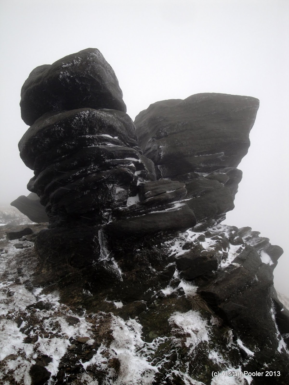
Tombstone like waymarker on the Hatterrall Ridge
I walked over the summit of the south top of Black Mountain (Nuttall) before reaching a path junction shortly afterwards, which was marked with a tombstone like waymarker.  Around 30 minutes or so later I reached the trigpoint on Red Daren, after having walked over the plateau of Pen-y-Garn Fawr.

Trigpoint on Red Daren
Looking back along the ridge from Red Daren
There were good views in all directions from Red Daren, and there was quite a contrast as to my west lay lots of snow whereas to my east lay predominately green fields - although I could just about make out the snow covered Malvern Hills in the distance to the east.  Around an hour and a quarter later I reached the next trigpoint on Rhiw Arw.

Rhiw Arw trigpoint
The walking along this section of ridge was very pleasant, with were excellent views of my next objective, Hatterrall Hill, as well as down into the Vale of Ewyas.

Hatterrall Hill
Looking down into the Vale of Ewyas
The Offa's Dyke Path skirted my next hill but didn't quite visit its summit so I set off through the un-walked deep snow to reach the small cairn on the summit of Hatterrall Hill (Dewey).  A combination of the wind and the late afternoon sun made for some pretty patterns in the snow near the summit.

Cairn on the summit of Hatterrall Hill
Snow patterns on Hatterrall Hill
It was extremely hard going through deep snow covered heather as I returned to the Offa's Dyke Path, which was only a few hundred metres away!  There were good views south along the final section of the ridge and soon after 7pm I reached the final trigpoint of the day, located on the south ridge of Hatterrall Hill.

Looking south from Hatterrall Hill towards Ysgyryd Fawr
Trigpoint on south ridge of Hatterrall Hill
There were good views of the sunset from the trigpoint and after a further 40 minutes or so I reached my first road since leaving the Gospel Pass road at the northern edge of the ridge.  Given the lateness of the hour, I opted to follow the road to Pandy where I arrived at my lodgings for the night at the Park Hotel at 8:30pm.  After a quick change I headed for the Old Pandy Inn, where I arrived just before they stopped serving food at 9pm.  It had been a good days walking, although it was quite long at 11 hours!  So after pie, chips and a couple of pints of Wye Valley Ale I returned to my room for a well earned sleep!

N.B. 03/06/13 - Post date updated to actual date of walk, i.e. 31/03/13 (from 14/04/13).  Links to trig points visited on the walk have also been added.

Saturday 30 March 2013

Offa's Dyke Path - Day 9: Kington to Hay-on-Wye

Saturday 30th March 2013 

Another snowy day on the Offa's Dyke Path over Hergest Ridge and other hills near the Welsh border

Distance: 24.5km; Ascent: 900m; Dry with occasional sunny spells and a chilly wind; Solo


After an excellent breakfast I set off walking around 9:30am in the sunshine :-)  I ascended gradually along the icy Ridgebourne Road past Hergest Croft Gardens to reach the edge of town, where a sign thanked walkers for visiting Kington.

Leaving Kington
Soon I reached the road end and continued along a well worn track through the snow, following some other Offa's Dyke walkers I had met in the pub last night.  There were good views as I ascended up the east ridge of Hergest Ridge past a strangely sited group of monkey puzzle trees to reach the windy summit plateau.

Ascending Hergest Ridge
Monkey Puzzle trees on Hergest Ridge
I detoured south through deeper snow to visit the trigpoint a few hundred metres south of the Offa's Dyke Path before heading west to the pile of boulders that marks the true summit of Hergest Ridge (Marilyn).  I could see a few other people out walking this morning, although most of them seemed to be sticking to the well worn tracks through the snow along the Offa’s Dyke Path.

Trig point on Hergest Ridge
True Summit of Hergest Ridge
I waded westwards through deep snow and heather to return to the Offa's Dyke Path, which I followed south-westwards along the lovely ridge with excellent views all around.  Around now I spotted a Red Kite soaring high above the ridge.

Red Kite soaring over Hergest Ridge
In Gladestry I stopped for a late morning break on a handy bench at the bus stop, which I guessed was pretty lightly used given that there was only one bus a week!  It was deceptively warm here this morning out of the bitter wind.

Snow drifts south of Gladestry
On Disgwylfa Hill
I pushed on across more farmland to reach the open access land of Disgwylfa Hill, where I stopped for lunch in the shelter of a small hummock.  There were good views from up here, but it was bitterly cold exposed to the easterly wind.  I descended to the small hamlet of Newchurch before skirting the eastern slopes of Little Mountain, where the sheep had sought out the small sections of ground not covered by snow.

Newchurch
Sheep on Little Mountain
There were good views over to the Black Mountains, which would be my hills for tomorrow.  After a welcome few hundred metres of road walking, due to it having been cleared of snow, came half a kilometre of deep snow covered track where I met some Offa’s Dyke Path walkers who had set off from Hay this morning.  They had tales of very deep mud and a poorly signed diversion in Bettws Dingle.

The white looking Black Mountains
Another section of road walking brought me to near the western edge of Bettws Dingle, where there were clear signs indicating the diversion.  However I still took the precaution of photographing the diversion map just in case.  After a few hundred metres the diversionary route led me down into the valley, where several diggers had been making a right old mess!

Diggers making a mess in Betws Dingle
There was plenty of mud around here, with the fallen over diversion signs partly hidden by a digger – I guessed it was around here the other walkers had got lost.  After referring to my photo of the diversion map I was soon back on the right course and continued my descent to the busy A438 road.

An unpleasant few hundred metres of road walking then followed, before I picked up a pleasant footpath across the fields to the River Wye and Hay Bridge.  Walking across the bridge into Hay-on-Wye, I was pleased to discover that my accommodation for the night was one of the first buildings I reached!  And it was appropriately named “Rest for the Tired”!

Hay Bridge
I arrived around 5:30pm and after watching Doctor Who, I nipped out to the shops to replenish my food supplies for tomorrow’s long day across the Black Mountains.  Also given the forecast for extensive sunshine tomorrow I went on a sun cream hunt, which was surprisingly tricky given the time of year – eventually the Co-op found some in their storeroom left over from last summer!  After a welcome dinner of haddock and chips in the Three Tuns, washed down with a couple of pints of Wye Valley ale, I retired to bed after another good long day’s walking.

N.B. 03/06/13 - Post date updated to actual date of walk, i.e. 30/03/13 (from 10/04/13).  A link to Hergest Ridge trigpoint has also been added.

Friday 29 March 2013

Offa's Dyke Path - Day 8: Knighton to Kington

Friday 29th March 2013

A long walk through deep snow on the English/Welsh border with excellent views

Distance: 22km; Ascent: 730m; Dry but mostly overcast with a bitter wind; Solo


My original plans for an Easter backpack in the wild mid-Wales hills were shelved due to the recent heavy snowfall and the prolonged cold weather as I decided I didn't fancy three nights wild camping in the snow. So instead I decided to return to the Offa's Dyke Path for a few days, which meant could stay in the warm overnight.

Knighton Clock Tower
Knighton in the snow
I stepped off the train at Knighton to find several inches of snow still lying on the platform; this was a sign of things to come! Walking through the town was easy due to the roads and pavements having been cleared of snow, but I was soon ascending through some very wintry woods. As I gained height the depth of soft snow increased to around a foot, but luckily there was a clear trail of footprints to follow.

Snow on the edge of Knigton Golf Course
Gate half-buried by snow
I continued southwards along the Offa's Dyke Path, where the snow lay so deep that it was possible to easily step over the gates - well it was certainly easier to do that rather than trying to open the gates, which would have probably required a snow shovel to achieve!

Looking south along the Offa's Dyke Path near Rhos-y-merich
A good trail through the snow brought me to the road at Rhos-y-meirch, which had been completely cleared of snow.  A short road walk followed, before rejoining the Offa's Dyke through some deep snow.  Soon I reached the road again where I chatted to a family who had been sledging on the nearby hill.

Obelisk north of Hawthorn Hill
I then passed within a few hundred metres of an obelisk, which commemorated Sir Richard Green-Price according to my Offa's Dyke Path guidebook.  Soon I stopped for lunch in the shelter provided by a small forestry plantation, before continuing on up Hawthorn Hill.  Here the snow depth varied considerably with much of the dyke almost completely clear of snow, whereas in some places it had drifted so much that entire fences and gates were engulfed with only small section poking up above the snow!

Offa's Dyke on Hawthorn Hill
Snow drifts covering a fence on Hawthorn Hill
There were reasonable prints in the deep snow to follow on the descent from Hawthorn Hill.  There were also at least a couple of sets of ski tracks too - clearly some people had been out ski touring up here recently!  After crossing the road at Dolley Green, the path ascended yet another hill before entering the shelter of Granner Wood, where snow lay heavily on the trees.

Snowy tree in Granner Wood
A pleasant descent then followed to reach the English border just south of Ditchyeld Bridge, only a few kilometres north of Kington, which lay beyond a small group of hills.  A reasonable path made for an easy snowy ascent up onto Herrock Hill Common.

Looking SW from Herrock Hill Common
Here I headed east for around a kilometre in a bitterly cold wind, following the Offa's Dyke over Rushock Hill; again here the wind had blown much of the snow off the top of the dyke.

Offa's Dyke on Rushock Hill
I was glad to leave the dyke and escape the bitter wind as I began to descend towards Kington.  After crossing several fields, I entered Kington Golf Course on Bradnor Hill - I doubted that there had been much golf played here in recent weeks!

Kington golf course on Bradnor Hill
My original plan was to detour up to the summit of Bradnor Hill around a kilometre from the Offa's Dyke Path, but I was quite exhausted from having spent the day walking through the snow that I instead opted to descend straight to Kington and the warm, friendly surroundings of The Royal Oak pub, where I stayed for the night.  It had been a good day and after a pizza and a couple of pints of Wye Valley beer, I was ready for an early night at shortly after 9pm! 

N.B. 03/06/13 - Post date updated to actual date of walk, i.e. 29/03/13 (from 09/04/13) 

Easter Backpack Plans: Knighton to Abergavenny along the Offa's Dyke Path

I'm currently sat on a train to Knighton, from where I'll shortly be starting to walk south on the Offa's Dyke Path for 3-4 days. The plan at present is to walk to Kington today and then onto Hay-on-Wye tomorrow. Then ideally on Sunday I'll walk over the Black Mountains to Pandy, but I'll wait and see what the snow conditions are before finalising my onward route from Hay-on-Wye. All being well I should arrive into Abergavenny sometime on Monday.

Saturday 16 March 2013

A Short Wander Around Powis Castle Gardens

Saturday 16th March  

On our way to meet friends in mid-Wales for the weekend we stopped off at Powis Castle, on the edge of Welshpool, for a short wander around the castle and gardens; nothing too strenuous as we were all recovering from a winter cold!  Here's a few photos from the afternoon showing the good views, including across the Severn valley to the Long Mountain where I was walking two weeks ago on the Offa's Dyke Path.

Powis Castle
Powis Castle Gardens
The Long Mountain from Powis Castle
N.B. 02/06/13 - Post date updated to actual date of walk, i.e. 16/03/13 (from 22/03/13) 

Saturday 9 March 2013

TGOC Spring Gathering: Kinder From Snake Pass Inn

Saturday 9th March 2013

A wander along the northern edge of Kinder before descending down Ashop Clough

Distance: 15km; Ascent: 550m; Light snow, low cloud with a bitter wind; with lots of TGO Challengers


Despite neither of us actually being on this year's TGO Challenge we decided it would still be nice to head over to the Snake Pass Inn for the Spring Gathering, especially as it's not too far from home. This year we booked a room for Friday and Saturday nights so we could both attend the meal.  After a sociable Friday evening in the pub, I joined a large group of TGO Challengers at 10am on the Saturday morning for a walk along the northern edge of Kinder Scout from the pub.

Group of TGO Challengers by the Fair Brook
We crossed the Fair Brook and began to climb roughly southwards, up into the mist and snow to reach the edge of the plateau, with some breaks on route to allow everyone to catch-up.  After a bit of a wander along Seal Edge we stopped for a spot of lunch in the small amount of shelter provided by some of the gritstone outcrops.

Heading into the mist and snow
Lunch in the mist
There was a surprising amount of old snow remaining up here from the previous snowfalls, which was hard in some places, and soft and quite deep in others.  After crossing the Fair Brook for the second time today, we reached Fairbrook Naze before continuing westwards along the edge.  The windblown snow had created some nice patterns in the rocks and grass along the edge.

Snowy rocks
Snowy grass
After reaching the western end of the edge we descended north-westwards to the junction of the Pennine Way and the Snake Path.  Here we opted to descend directly back to the pub, by following the Snake Path down Ashop Clough.

At the path junction above Ashop Head
This way to the pub!
Now that we were out of the cloud, the group gradually began to split up and I spent most of the rest of the walk chatting with Andrew and Carl.  I had also not been this way myself before so it was nice to be walking somewhere new so close to home.

On the Snake Path in Ashop Clough
Ashop Clough
The valley became quite steep sided as we descended eastwards, with some views back westwards towards Kinder and Mill Hill.  As I crossed Upper Gate Clough, I spotted something interesting a hundred metres or so upstream so I decided to go and investigate.  It turned out to be some sort of measuring instrument, which was presumably measuring water flow in the beck.

Measuring instruments in Upper Gate Clough
Sign at the east end of the Snake Path
The last kilometre or so was through the forest back to the pub, where I found Lynsey & Isabel waiting for me at around 4pm.  That evening there was well attended sociable meal in the pub's function room, during which it started to snow.  Here are some links to Martin's and Gayle's reports of the weekend, and many thanks to Alan for organising an excellent weekend :-)

N.B. 02/06/13 - Post date updated to actual date of walk, i.e. 09/03/13 (from 20/03/13)