Monday 26 November 2012

Beinn Udlaidh and Beinn Bhreac-liath

Monday 26th November

A round of two snow covered Corbetts from Glen Orchy

Distance: 14km; Ascent: 960m; Mostly overcast, but sunny later; with Colin

We had toyed with the idea of bagging Gairich above Loch Quoich today, but decided that would leave us with too long a drive home afterwards.  Therefore instead we opted for a pair of pleasant sounding Corbetts above Glen Orchy.  By the time we had packed up and driven down from Roybridge, it was 9am by the time we set off walking from near Invergaunan in Glen Orchy.

Looking down the Allt Ghamhnain valley towards Ben Inverveigh
A rough vehicle track headed through the forest close to the Allt Ghamhnain, which made for relatively easy going through the forest plantations.  Our plan had been to strike uphill once out of the forest so as to gain the north ridge of Beinn Udlaidh.  However when we reached this point, the route of ascent didn't seem too appealing and there was also the added problem of a newish deer fence with no certainty of a crossing point further uphill.  Therefore we instead continued along the rough track through a large area of recently planted trees, with the aim of heading uphill once we left the deer fence enclosed area.  It was pleasing to see that the newly planted trees were a mixture of different species and not just regimental rows of pines!

New tree planting
Southerly edge of the new deer fence in Coire Ghamhnain
It transpired that the newly enclosed area extended somewhat over a kilometre further up the coire from the edge of the established woodland, so that by the time we had got to its southerly end the most obvious route up onto the hills was simply to head up the slopes of the coire headwall to gain the bealach, so this is what we did.

View from the bealach
Loch Tulla from the E ridge of Beinn Udlaidh
By the time we had reached the bealach we were well above the snow line, and also now exposed to a bitter wind, but there were some excellent views to the south east from here.  We headed up the east ridge of Beinn Udlaidh, carefully picking our way through a couple of steeper rockier sections, to reach the summit plateau, which was in the cloud.  We reached the large cairn at around 12:30pm, which was surrounded by a few random abandoned bits of old machinery.  We stopped here in the shelter of the cairn for a bite to eat before heading a hundred metres or south southwards to visit the true summit of Beinn Udlaidh (Corbett, Marilyn).

Abandoned machinery near the summit of Beinn Udlaidh
By the large cairn on Beinn Udlaidh
True summit of Beinn Udlaidh
Due to the wind, we didn't linger at the true summit for long and soon we were descending back down to the sunny bealach, with excellent views once we dropped below the cloud.

Semi-frozen lochan in the bealach
Beinn Udlaidh from the ascent of Beinn Bhreac-liath
We began the ascent of Beinn Bhreac-liath and were soon back in the cloud trying to find the summit of another plateau.  We found two small cairns around a hundred metres apart and visited both of them to ensure that we had visited the summit of Beinn Bhreac-liath (Corbett, Marilyn).

On the summit of Beinn Bhreac-liath
The NNW ridge looked to be a pleasant route of descent on the map, so that is the route we took.  The first couple of kilometres were very level and so we remained in the cloud, but once we started to descend there were excellent views across to the Black Mount.

The Black Mount from the N ridge of Beinn Bhreac-liath
At around 3pm the sun finally managed to appear between the clouds, but it was not for long as around 30 minutes later it set behind the north shoulder of Beinn Udlaidh; however there were some good views.

"Self Portrait" on the N ridge of Beinn Bhreac-liath
Sunset from the N ridge of Beinn Bhreac-liath
Soon we were below the snowline and descended in the dusk to Invergaunan and beyond to the road.  We returned to the car at around 4pm and drove south happy after a fantastic four days hillwalking in the Highlands.  I shall have to plan another trip back there in the New Year!

N.B. 13/02/13 - Post date updated to actual date of walk, i.e. 26/11/12 (from 31/12/12) 

Sunday 25 November 2012

Ciste Dhubh and Am Bathach

Sunday 25th November

A day walk up a snowy Munro and Corbett from Glen Shiel

Distance: 14km; Ascent: 1360m; Overcast but mainly dry; with Colin

After curtailing our planned backpack yesterday due to deep snow, we decided to base ourselves in Roybridge for a couple of nights.  It turned out that Ciste Dhubh was one of the closest Munros to there that neither Colin or I had previously climbed and so that is where we headed today; it also had the option of bagging a bonus Corbett should there be enough time and daylight available after the Munro.

Heading along the Allt a' Chaorainn Bhig
Therefore shortly after nine o'clock this morning we left the car by the A87 and picked our way through an unpleasant area of felled forest to reach a faint path heading alongside the Allt a' Chaorain.  We ascended gently up the glen to reach the snow line some distance below the Bealach a' Choinich.

Looking down An Caorann Beag
We took a brief rest in the broad bealach before beginning our ascent up steep soft snow so as to become established on the south ridge of Ciste Dhubh.  There were good views back towards Am Bathach, but they were soon gone as we ascended into the clouds.

Am Bathach from the southern slopes of Ciste Dhubh
The south top of Ciste Dhubh
We skirted the impressive looking south top to reach the summit of Ciste Dhubh (Munro, Marilyn) shortly after 1pm.  By now the cloud had started to thin out, so we were afforded with intermittent views across to the surrounding hills.  We found a bit of shelter just below the cairn so we stopped here for lunch.

On the summit of Ciste Dhubh
However we didn't linger long on the summit due to the chilly wind, and we were soon descending back down the south ridge.  And the improving visibility meant that there were some good views of the imposing crags too.

Descending the south ridge of Ciste Dhubh
The crags of Ciste Dhubh
Soon we were back at the top of the steep snow slope, which we began to pick our way down.  Lower down, once the angle had eased slightly, we glissaded down the rest of the slope back down to the bealach.  Then we ascended up the snowy NW ridge of Am Bathach with excellent views across to Sgurr an Fhuarail and the South Glen Shiel ridge.

Sgurr an Fhuarail from Am Bathach
Clouds above Glen Shiel
At around 2:45pm we reached the summit cairn of Am Bathach (Corbett, Marilyn), where we rested a while to take in the impressive views now that the cloud had lifted.  

On the summit of Am Bathach
We continued along the long SSE ridge of Am Bathach, with excellent views on down the ridge towards Loch Cluanie.

Loch Cluanie from the SSE ridge of Am Bathach
Late afternoon clouds above the South Glen Shiel ridge
By now it was late afternoon and there were some wonderful colours in the clouds above the South Glen Shiel ridge.  We descended down the ridge to the SE and at around 4pm we dropped below the snow line, before following an intermittently boggy path back down to the car in the gathering gloom.  Just before 4:30pm we reach the car after another excellent snowy day out hillwalking in the Highlands :)

N.B. 13/02/13 - Post date updated to actual date of walk, i.e. 25/11/12 (from 31/12/12) 

Saturday 24 November 2012

A Somewhat Shorter Mullardoch Backpack - Day 2

Saturday 24th November

An unplanned retreat from the high hills, but with excellent views of snowy peaks!

Distance: 8.5km; Ascent: 170m; Sunny; with Colin

Well, last night will probably go down as one of my worst night's sleep in a tent since sitting out a storm on the first night of the 2009 TGO Challenge near Loch Calavie (a mere 13km away to the WNW from my current location).  This was almost certainly due to the frequent gusts of wind shaking the tent and depositing spindrift on the end of the tent where our heads were, which then in turn gradually melted and dripped onto us!  Also after I had a slightly cold night, I made a mental note to make sure I brought a thicker sleeping mat next time I camped on snow! 

Our tent at dawn
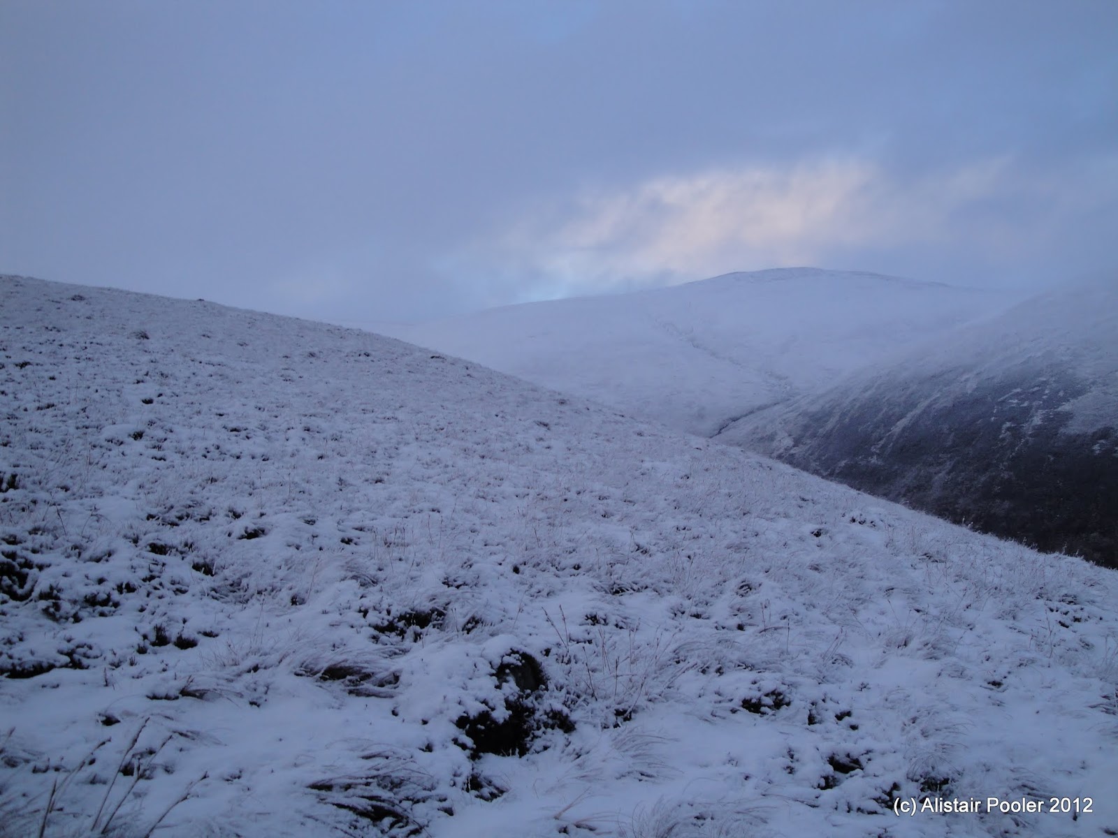
At around 7:30am, as dawn broke, we ventured out of the tent to find that the sky was clear and the wind had dropped a bit.  I had been unable to find the gloves that I wore for much of yesterday and came to the conclusion that they must be near the false summit cairn (as that's where I had changed into my thick gloves yesterday).  Therefore I toddled off for what should have been a quick walk over to the cairn, but the soft snow was over knee deep so my progress was very slow!  However I was rewarded with excellent views of the dawn light :-)

False summit of Carn nan Gobhar at dawn
Sgurr na Lapaich at dawn
Initially there was no sign of my gloves by the cairn, but I soon found them after poking around in the snow with my poles - they were frozen solid!  Gloves retrieved successfully, I now returned to the tent by a slightly longer route to try to avoid the deeper areas of snow.

Our scenic overnight halt
Sunrise from our overnight camp high on Carn na Gobhar
We concluded that due to the deep covering of snow present on all our planned hills, our progress would be significantly slower than planned.  And this, combined with the short daylight hours, meant we were extremely unlikely to complete our planned round by Monday lunchtime.  Therefore we made the hard decision to bail out of our planned backpack, rather than heading further into the remote hills.  Instead we would head east to Creag Dubh and then down into Coire an t-Sith, before following the Allt Mullardoch back down to Loch Mullardoch.

Colin headed up to the summit of the Munro to admire the views, whilst I headed back inside the tent to pack up my stuff.  Soon Colin returned and at around 9:15am I set off for the summit, grateful for Colin's steps in the deep snow.  Soon I reached the summit cairn of Carn nan Gobhar (Munro, Marilyn) and was admiring the absolutely fantastic views of snowy mountains in every direction!  Sgurr na Lapaich looked particularly impressive out to the west and there were also good views down to the east end of Loch Monar and the Strathfarrar Munros.

Summit of Carn nan Gobhar
Sgurr na Lapaich from Carn nan Gobhar
Looking north towards Loch Monar and the hills beyond from Carn nan Gobhar
I returned to Colin, and after finishing packing the tent away, we headed ENE along the broad ridge toward Creag Dubh.  There were fantastic views in all directions, although dark clouds were beginning to gather on the western horizon indicating the change in weather forecast for this afternoon.  At around 10:30am we reached the summit of Creag Dubh (Munro Top).

Cairn on Creag Dubh
We found a nice sheltered spot to stop for a rest in the lee of a snow bank, from where we admired the amazing views.  Owing to the hour of the day, the views to the north and west were the best, especially towards Loch Monar, Glen Strathfarrar and the hills beyond.

Looking down Glen Strathfarrar from Creag Dubh
Looking back towards Sgurr na Lapaich from Creag Dubh
The Munros at the head of Loch Monar
Loch Monar dam and the Strathfarrar Munros
Eventually we decided that it was time to say goodbye to the high hills, so we headed east for a short way before descending down into Coire an t-Sith.

Creag Dubh from Coire an t-Sith
As we descended the snow turned to slush mixed with peat bog, but amazingly neither of us slid over on the slippery terrain!

Descending by the Allt Mullardoch
In the corrie floor we picked up a bit of a rough track, with newish looking bridges over some of the burns, which we followed downstream past some waterfalls to reach Loch Mullardoch.

Waterfall on the Allt Mullardoch
Loch Mullardoch
By this point Colin, who seemed to have loads more energy than me today, had zoomed off ahead in a bid to collect the car to save me walking round to the far side of the dam, which was nice!  Although I secretly just think he was in a hurry to get to Fort William for some tea and cake ;-)

Clan Chisholm monument
On the way back to the dam, I came across a large cairn and decided to take a look.  It was a monument to Clan Chisholm, which marked the location of where, according to tradition, the chief held counsels with his Glen Cannich clansmen.

Loch Mullardoch dam
Soon I was back at the south end of the dam, with no sign of Colin so I continued along the minor road and I got almost as far as the road junction before he met me.  After changing into drier clothes, we set off for Fort William to buy a new compass and adjourn to a cafe for an hour or so.  As Colin was a member of the Climbers' Club we had already decided where we were going to stay for the night: their hut in Roybridge.  The hut turned out to a most pleasant bunkhouse, where we made plans for some shortish day walks for the next couple of days.

N.B. 13/02/13 - Post date updated to actual date of walk, i.e. 24/11/12 (from 11/12/12) 

Friday 23 November 2012

A Somewhat Shorter Mullardoch Backpack - Day 1

Friday 23rd November

An afternoon Munro ascent to start our backpack, with an adventurous summit camp

Distance: 7.5km; Ascent: 850m; Light snow; with Colin

Colin arrived by train in Stockport yesterday evening and, after pizza for dinner, we drove north to a Travelodge on the outskirts of Perth for the night.  A lack of time during the previous week had meant that I hadn't had time to pack and had merely thrown everything I might need into the car!  Therefore this morning, Colin headed out to buy food for the weekend whilst I organised my gear and was pleasantly surprised to discover that I hadn't forgotten anything crucial!  I had however brought lots of unnecessary stuff - oh well it would just have to sit in the boot by Loch Mullardoch for the 4 days!

It probably won't have escaped your attention that we woke up in Perth this morning, which is still a heck of a long way away from Loch Mullardoch!  Therefore this morning was spent driving north to Inverness and then slightly south again to Drumnadrochit before heading west to Cannich and then finally along the single track road to Loch Mullardoch, where we had lunch in the car whilst watching the rain!

Loch Mullardoch dam
At around 1:30pm we set off walking back down the road from where we parked the car!  The reason for this was due to the fact that it's not possible to walk across Loch Mullardoch's dam as there's a significantly sized section without a walkway above it!  And as today's walk was the shortest in terms of distance we decided to get the tedious road walk around to the north side of the dam done today.  However we were soon at the road end on the north side and continued along the initially reasonable track.

Heading west along the north shore
The track soon deteriorated into a boggy mess due to the large amount of recent rainfall.  After a kilometre or so we reached a newish looking bridge over the Allt Mullardoch and just beyond a small cast iron shelter, where we took brief refuge from the rain.  Soon we began the steep ascent up the SE slopes of Mullach na Maoile and the rain stopped - only to be replaced with snow.  The ground was very heathery around here and as we got higher it was covered in a layer of fresh snow, which made for slow, slippery progress!

Resting in the snow
However eventually the angle of the slope eased as we became more established on the ESE ridge of Mullach na Maoile.  Around this time the cloud lifted a bit and the snow stopped for a while, which meant we had some good views back down to Loch Mullardoch and up into Coire an t-Sith towards Creag Dubh.

Loch Mullardoch from the slopes of Mullach na Maoile
Creag Dubh from slopes of Mullach na Maoile
After what seemed like ages, we finally reached the summit of Mullach na Maoile.  By now it was becoming clear that due to the fresh snow we were unlikely to reach our planned campsite by Loch Tuill Bhearnach before nightfall.  However the snow did bring the advantage that as long as we camped above the snow-line we would have a water supply regardless of where we ended up pitching.  Therefore we decided to press on up our first Munro of the trip and we could always camp somewhere near the summit if necessary.

Approaching the summit of Mullach na Maoile
The ascent of the SSE ridge of Carn nan Gobhar seemed to take a long time, not helped by the strong westerly winds blowing spindrift into our faces!  Around half-way up we dug out our torches as the gloom was gathering somewhat.  The upper section of the ridge made for slow progress through snow covered scree, but we eventually reached the large cairn at the false summit.  I dug out my thicker gloves in the shelter of the cairn and we continued onto the true summit a couple of hundred metres away.

Various reasons resulted in us deciding against descending the west ridge by torch light and, as the summit area was too stony and exposed to the wind to be a pleasant spot for camping, we instead descended east away from the wind.  After a couple of hundred metres we found a slightly more sheltered area and so opted to camp here.  As the snow was fresh we had to clear a lot of it out of the way to allow us to pitch the tent such that the tent pegs were actually anchored into the ground, rather than the snow.  However we soon had the tent up and were safely inside the warmth of our sleeping bags having dinner - I was glad I had brought my winter bag with me!

N.B. 13/02/13 - Post date updated to actual date of walk, i.e. 23/11/12 (from 04/12/12)