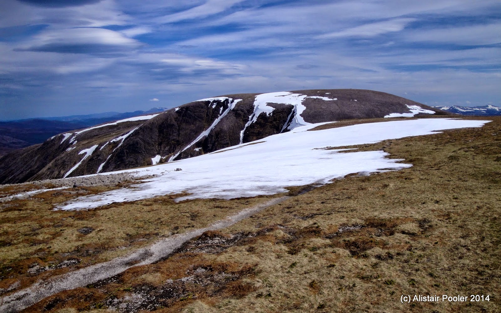
Showing posts with label Marilyns. Show all posts

Thursday, 2 October 2014

TGOC 2014 - Day 8: Ruigh Aiteachain to Glen Dee

Friday 16th May 2014

An excellent high level day over four Munros between Glen Feshie and Glen Dee 

Distance: 30km; Ascent: 1470m; Sunny but quite windy on the tops; with Sue O

The hills were under a blanket of low cloud when I met Sue outside the bothy this morning for our day of Munro bagging; we hoped the forecasted lifting of the cloud in the morning would turn out to be correct!  At 8am we set off walking, initially retracing yesterday's steps for the best part of a kilometre, before picking up the vehicle track that climbs up towards the plateau.

Looking across Glen Feshie to Carn Dearg Mor
Coire Garbhlach
The track made for very quick progress and it wasn't long before we we looking into the misty Coire Garbhlach, and around here we passed another challenger heading into the high hills for the day. As we continued to ascend the cloud gradually began to clear, with most of it having cleared by around 9:30am.  We detoured south for around a kilometre to visit our first windy summit of the day: Mullach Clach a'Bhlair (Munro, HuMP).

On the summit of Mullach Clach a'Bhlair
Returning to the LRT we headed northeast across the plateau, before stopping for a break in the slight depression formed by the upper part of the Caochan Dubh burn.  I was keen to include Sgor Gaoith in today's walk, which would result in a detour of around 7km - luckily Sue was quite happy to have a long day in the hills as well!

Continuing onwards, we left the LRT after around a kilometre to head NW to the summit of Carn Ban Mor (Munro Top), before we continued NNE towards Sgor Gaoith in a strengthening westerly wind.  Approaching Sgor Gaoith from this direction, it just looked like a small lump in the moorland but as we got closer it revealed it's true nature and we were rewarded with excellent views of it's craggy eastern side above Loch Einich.

Heading up the southern slopes of Sgor Gaoith
The impressive craggy arete on the east side of Sgor Gaoith
Looking across the head of Loch Einich towards Carn na Criche and Monadh Mor
Shortly before midday, we reached the very windy summit of Sgor Gaoith (Munro, Marilyn), which I didn't dare stand up on as it is perched above the precipice of the east face and there was a pretty strong westerly wind today!  Therefore I briefly sat on the summit instead to avoid being blown over, whilst admiring the truely fantastic views out over the main Cairngorm hills to the east and over the Moine Mhor towards our next hills of the day: Monadh Mor and Beinn Bhrotain.


On the summit of Sgor Gaoith
Carn na Criche and Loch Einich from Sgor Gaoith
Gleann Einich, Braeriach and Loch Einich
Looking NNW from Sgor Gaoith
We retraced our steps southwards towards Carn Ban Mor in strong winds, before heading SE after a kilometre and a half aiming for a faint track we could pick out traversing the northern slopes of Tom Dubh.  We could pick out a handful of people in the distance across the Moine Mhor, who looked to be heading in a variety of directions towards Braeriach, Cairn Toul and Monadh Mor.  In fact seeing these people in the distance helped demonstrate the huge scale of the Moine Mhor, or Great Moss.  It was a fantastic day to out on the hills :-)


Heading back down the south ridge of Sgor Gaoith
At around 13:20, we stopped for lunch in the small amount of shelter afforded by a cairn on the northern slopes of Tom Dubh.  I nipped off to the south to visit a couple of cairns on the summit of Tom Dubh (Munro Top), before returning to our slightly sheltered spot for lunch.  From here we could pick out what looked to be a sensible looking route onwards to our next objective: Monadh Mor.

One of the several cairns on Tom Dubh, with Carn na Criche, Sgor an Lochain Uaine and Carn Toul beyond
We descended slightly to reach the partially snow covered Allt Luineag, which looked to be surprisingly full today - I presume due to the ongoing melting of the large number of snow patches still remaining high up in the hills.  To cross this without getting cold, wet feet necessitated a detour of a few hundred metres upstream to where the burn was braided into two separate channels.

The Allt Luineag
Once safely across the Allt Luineag, we picked a route in a more or less south-easterly direction up Monadh Mor, following a burn for some of the first kilometre.  As we ascended the ground became more bouldery, which necessitated a slow down in our pace due to the combination of the rocky ground and today's strong winds.  Nevertheless, we eventually reached the cairn on the summit of Monadh Mor (Munro, HuMP) at around 3pm, where we stopped for a short while to admire the truly fantastic views!

Monadh Mor summit cairn, with Beinn Bhrotain beyond
Carn na Criche, Braeriach, Sgor an Lochain Uaine and Carn Toul from Monadh Mor summit
On the summit of Monadh Mor
Not wanting to linger too long on the exposed summit, we soon continued towards our final hill of the day: Beinn Bhrotain.  There were a fair number of snow patches still on the southern ridge of Monadh Mor, but we were able to easily avoid them all as we skirted the southern top to reach the top of the steep descent down to the 975m unnamed bealach.


Traversing the very windy southern slopes of Monadh Mor (hence the tilted camera angle!)
Beinn Bhrotain from the SSE slopes of Monadh Mor
Looking across the 975m bealach to the steep climb ahead up Beinn Bhrotain
Snow on the eastern slopes of Monadh Mor
From the bealach there was a good view across to Beinn Bhrotain, where we could pick out a path up the first half of the ascent before it looked to become bouldery again.  Picking our way carefully down the steep slope we reached the 975m bealach, where we stopped for a quick break in this marginally more sheltered spot!  Continuing on, we ascended up the steep slopes on the eastern side of the bealach to reach the trigpoint on the 
the summit of Beinn Bhrotain (Munro, Marilyn) at 4:15pm.

The summit of Beinn Bhrotain
On the summit of Beinn Bhrotain
Carn na Criche to Ben Macdui from Beinn Bhrotain summit
Again the views were excellent from this vantage point, which was actually my highest point on my route for this year's TGO Challenge.  I'm not sure I've ever had quite such expansive views when out walking in the Cairngorms before!  My original plan had been to follow the SSE shoulder of Beinn Bhrotain down towards the Munro Top of Carn Cloich-mhuilinn.  However as it appeared that the wind had noticeably strengthened throughout the afternoon, Sue and I were both keen to get out off the wind as soon as possible.  Therefore instead we opted to descend eastwards along the pleasant clear waters of the Allt Garbh.

The lovely clear waters of the Allt Garbh
Looking across Glen Dee to Sgor Mor
After much walking down through pathless heather we finally reached the floor of Glen Dee, and as it was now almost 6pm we started to look for somewhere to camp.  We didn't have to look far as we found a pleasant spot to camp in Glen Dee a short distance to the south of the Allt Garbh.  It had been a long day in the hills, but easily one of the best hill-walking days I've had this year :-).

During the early evening, the sky clouded over and there was light rain whilst I was cooked my dinner in the porch.  I must have been tired that evening, as after eating dinner I managed to fall asleep without zipping up the inner tent!  Not to worry, there'd be plenty of time for rest over the next couple of days as I only had half-day walks planned in and out of Braemar.

Our pitch for the evening in Glen Dee

Saturday, 27 September 2014

A Lunchtime Ascent of Cold Fell

Friday 26th September 2014 

A short circular walk up the most northerly 2000ft peak in the Pennines 

Distance: 9km; Ascent: 430m; Dry, sunny and windy; Solo

I had booked the day off work today, with the intention of going out hill-walking so I was quite pleased to discover that the weather wasn't forecast to be too bad :-)  I therefore decided to return to the North Pennines for the day to climb another couple of my outstanding 2000ft peaks in that area.  This entailed a drive north up the M6, stopping at Tebay for coffee and a Cumberland sausage roll, to reach the RSPB's Geltsdale car park at Clesketts, from where I set off walking at around quarter to midday.

The track up through the bracken above Howgill Beck
It was warm and sunny as I headed along the vehicle track towards the hills, and I soon reached Howgill from where the ascent proper began.  A grassy track aided my progress up the bracken covered slopes of the NE side of the Howgill Beck valley, past the RSPB's Bruthwaite viewpoint and on towards the moorland above.

Ruined building above the Howgill Beck valley
The track became fainter and wetter as I ascended further, and soon I reached a broad col to the north of Cold Fell itself.  From here I headed up the slopes to the south, whilst trying to avoid the worst of the peat hags!  At 1pm I reached the the trigpoint on summit of Cold Fell (Nuttall, Marilyn), where it was lovely and sunny but quite cold in the biting wind.

Summit of Cold Fell
I stopped for lunch in the windshelter, whilst admiring the expansive views out over the northern Pennines, Northumberland and southern Scotland.  I could also make out the Lakeland Fells to the SW, but they were quite hazy in the September sunshine.

Currick on Tindale Fell
After ten or fifteen minutes on the summit, I decided that I'd better get a move on as I still had a second walk planned for today, up Thack Moor to the south of here.  To vary my route I decided to head to the prominent tall currick on Tindale Fell that's pretty much due north from Cold Fell.  From here I began to descend steeply northwards, with excellent views down to Tindale Tarn and on over Hadrian's Wall country.

Looking down to Tindale Tarn
Tindale Tarn from the northern slopes of Tindale Fell
After a steep descent, in places through tall grass and bracken, I reached the valley floor at a vehicle track junction near the SW corner of Tindale Tarn.  A short ascent NW along the track lead to Thorn and then back to the car at Clesketts, where I arrived shortly after half past two after a pleasant few hours walking.

Thursday, 14 August 2014

TGOC 2014 - Day 6: Chalybeate Spring to Newtonmore

Wednesday 14th May 2014 

An excellent high-level day over two Munros on the edge of the Monadhliath Mountains 

Distance: 29.5km; Ascent: 680m; Dry and sunny, followed by showers; Mainly with John B

I woke at around 5am this morning due to the cold - there was a heavy frost outside and ice on the inside on my flysheet!  Therefore I added an extra layer and soon was back asleep for a couple of hours.  The vast majority of the other challengers camped at Chalybeate Spring were heading east from here, whereas I was planning on detouring to bag a Munro: Geal Charn.  This therefore meant that I set off walking alone at around 9am and followed the burn southwards to reach Loch na Lairige, which looked like it might be a pleasant spot to camp.

Camp by the Allt Mor
The Crom Allt below Loch na Lairige
The outflow of Loch na Lairige
Loch na Lairige
From Loch na Lairige I followed the Allt an Iuit up past several large snowfields to eventually reach the NE shoulder of Geal Charn, where I picked up a faint path through the moorland.  Around here I bumped into John Braide again!  He had just come from the summit, but opted to turn around and retrace his steps with me to the large summit cairn of Geal Charn (Munro, HuMP), which we reached at around half past eleven.

Snowfield SE of Loch na Lairige
Looking back to Loch na Lairige
Snowfields above the Allt an Iuil
On the summit of Geal Charn
Geal Charn summit cairn
John & I both had the same route planned for the next few hours, so after a short break we set off walking together in a north-easterly direction over the gentle rolling hills of the Monadhliath.  There were excellent views in all directions as we passed over the summit of Carn na Criche (Corbett Top) and the summit of Cairn Ewen before reaching the summit of Carn Odhar na Criche (Corbett Top), where we picked up a line of fence posts.

Looking NE from Geal Charn
Carn Odhar na Criche
From here we dropped ESE to seek some shelter from the brisk wind for a spot of lunch, before continuing on over Beinn Odhar and the former Munro Top of Sneachdach Slinnean before bumping into Chris Townsend and Tony Hobbs again.

Superfluous gate on the west slopes of Sneachdach Slinnean
Looking towards Carn Dearg from Sneachdach Slinnean
We walked together to the summit of Carn Ban (Munro Top), before continuing on to my final hill of the day: Carn Dearg (Munro, Marilyn), whose summit we reached at around twenty past three this afternoon.  As we reached the summit the threatening clouds finally started to rain, so we didn't linger long here.

John, Chris and Tony heading for Carn Dearg
Carn Dearg from the NNW
One of the remaining snow patches on Carn Dearg
Gleann Ballach from Carn Dearg
Summit cairn of Carn Dearg
We retraced our steps back to the bealach, where John left to continue on his high-level route through the Monadhliath for another day, whilst Chris, Tony & I descended NE into the coire at the head of Gleann Ballach.  Here we bumped into a team of balloon herders, also known as Andy, Alan and Phil, whose cheese and wine party I had attended last night.  After stopping for a chat, they continued down Gleann Ballach whilst Chris, Tony & I crossed over into the next glen to the east.

Alan, Andy & Phil in Gleann Ballach
Footbridge over the Allt Fionndrigh
After missing the start of the path shown on the OS map, we had a steep descent down to the Allt Fionndrigh, which we boulder-hopped across before finding that there was a bridge a few hundred metres further downstream.  By now it was around 5pm and as I was due to be meeting Martin in Newtonmore for a pub meal I picked up my pace and headed off down the vehicle track towards Glen Banchor.

Looking back up Glen Banchor
Soon after joining the minor road, I came across a welcome sign tied to a nearby tree - free tea, coffee and cakes! :-)

A welcome sign :-)
The River Calder NW of Newtonmore
Spurred on by the thought of this, I continued along the minor road into Newtonmore to reach the excellent Newtonmore Hostel, where I found Martin and I were sharing a room.  Martin headed out to the pub shortly after I arrived, whilst I enjoyed tea and cake before unpacking, grabbing a shower and heading over to the pub to join him.

I enjoyed a most sociable evening in the Glen Hotel with Martin, Markus, Philipp, Laura, Louise, David, Ali & Sue amongst many others :-)