Tuesday 13th August 2013
An evening walk up Grindsbrook Clough to reach the Kinder Plateau
Distance: 8.5km; Ascent: 410m; Dry, but breezy on the edge; Solo
Following Lynsey's
walk up Grindsbrook Clough last week, I realised that it was well over 3 years since I had last walked up onto Kinder Scout that way so I decided to head that way this evening. The Edale car park was pretty much deserted as I set off walking shortly after 7:30pm and headed up through the village, past the The Old Nags Head and out into the countryside.
 |
| Heading towards Grindsbrook Clough |
The flagged path led across the fields below The Nab, followed by a short section of woodland before crossing the burn exiting Golden Clough, which marked the start of open country.
 |
| Bridge over Golden Clough burn |
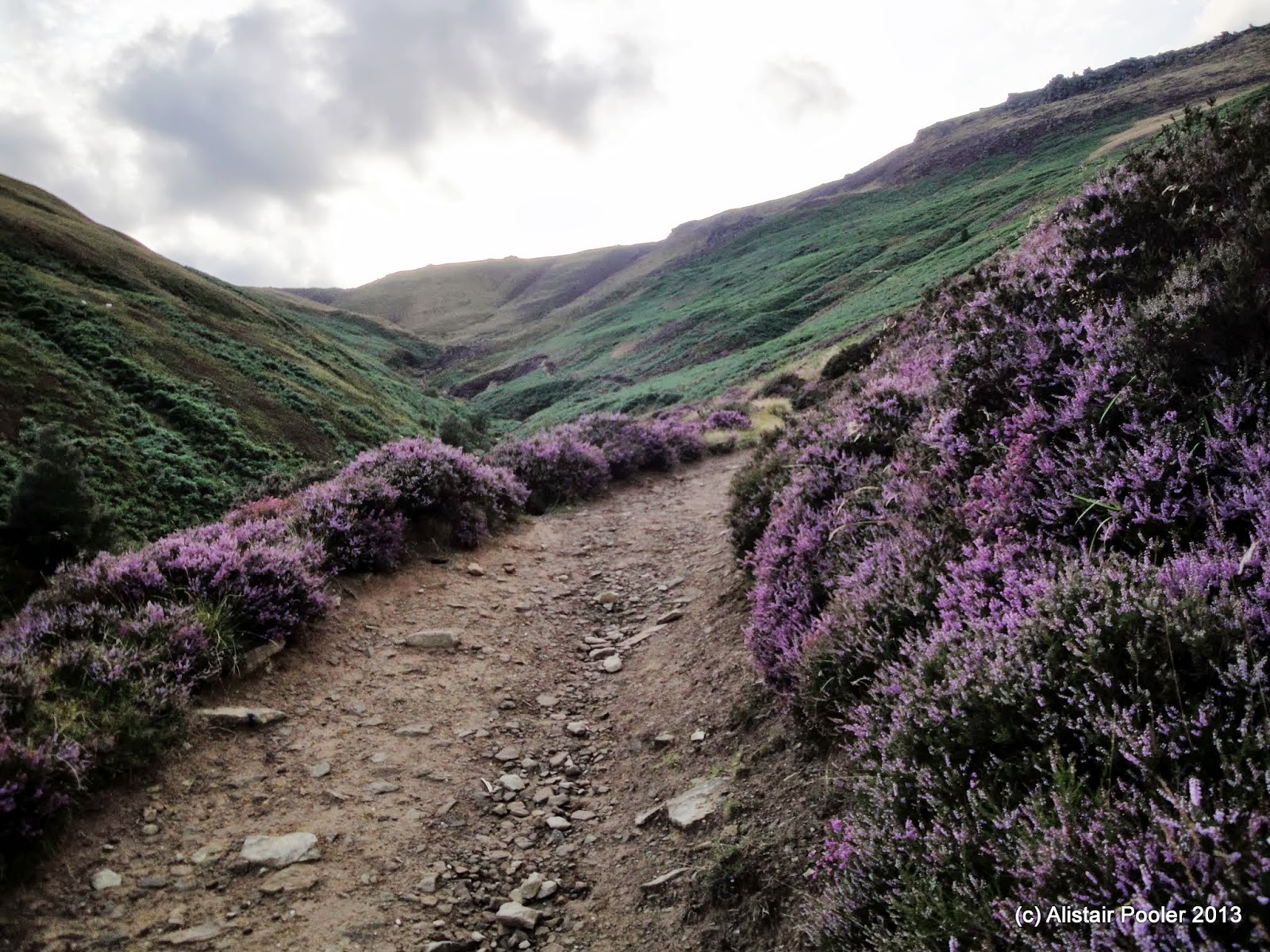
The track up Grindsbrook Clough was surrounded by lots of heather in full purple bloom, which is one of the things I like most about moorland walking at this time of year :-)
 |
| The track through the heather |
 |
| Heather |
As I ascended up the track the views back down the clough opened out and I began to see the Lose Hill - Mam Tor ridge on the other side of the Vale of Edale. Around a kilometre after crossing Golden Clough the path deteriorated and dropped down to the brook.
 |
| Looking down Grindsbrook Clough |
 |
| Grinds Brook |
I ascended up the narrowing clough, sometimes on the left of the brook, sometimes on the right and sometimes scrambling over the boulders in the brook itself. By the time I reached the fork near the top of the clough the light was beginning to fade, so I decided to ascend the ground to the right of the right-hand branch to gain the plateau-edge path.
 |
| Looking E along the southern edge of Kinder |
 |
| Looking down into Grindsbrook Clough at dusk |
 |
| Dusk sky over Kinder plateau |
Unfortunately I was around 15 minutes too late to catch a glimpse of sunset from the plateau, but there were still impressive views and lovely dusk skies. I headed east along the southern edge of the plateau, past the climbing crags of Upper Tor and Nether Tor to reach the top of Golden Clough - around now I donned my head torch as there was very little light left in the sky.
 |
| Looking towards Grindslow Knoll |
 |
| The last light of the day over Grindslow Knoll |
I began to descend from the plateau, traversing to the west of Ringing Roger to reach The Nab, from where a good path brought me back down to my route of ascent and thence Edale village. I reached the car shortly after 10pm after another good evening walk :-)
See also my Social Hiking
live map from the walk.


No comments:
Post a Comment