Distance: 21km; Ascent 680m; Solo
My most recent backpacking trip was now over three months ago and I was keen to get out backpacking again. I decided to have a crack at walking another long distance path over several weekend sections, as I did with the Pennine Way between 2008 and 2010. After studying various maps and public transport details, it seemed like the most likely contenders were the Dales Way and the Offa's Dyke Path with the latter slightly more preferable as it spends more time in the hills. I had also been thinking of returning to the Clwydian Range of hills since I made one brief foray there to climb Moel Famau a few years ago, and so my decision was made - the Offa's Dyke Path it is!
 |
| On Prestatyn Beach |
This morning I caught a succession of three trains from Stockport to Prestatyn, changing in Crewe, where I managed to grab a quick coffee and sausage sandwich between trains, and Chester. I wandered down to the beach from Prestatyn station to dip my boots in the sea, before having a look at the shiny sculpture that marks the start of the Offa's Dyke Path.

 |
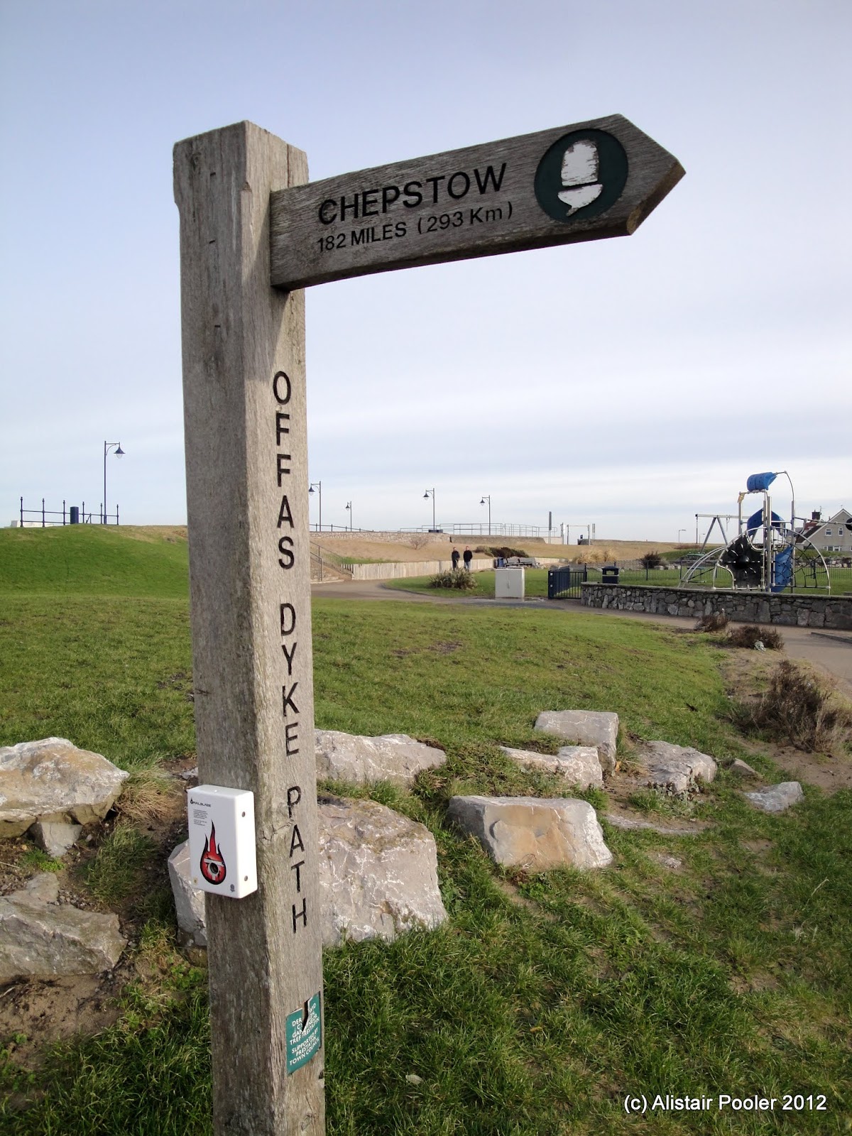
| Sculpture marking the start of the Offa's Dyke Path and sign showing indicating 182 miles to Chepstow |
I left Prestatyn beach at 10:45 and walked south, through the station and ascended up the high street to reach the Hillside Gardens on the south eastern edge of town, where there was a large sculpture of a Roman helmet. Slightly further up the hill, there was a sort of balcony from where there was a good view out over the town and the nearby coastline.
 |
| View from Hillside Gardens, Prestatyn |
I continued to ascend, with good views west across the hazy valley to the snow covered peaks of the Carneddau. Eventually the path levelled out and I headed south across the gorse covered hillside, high above the houses below. After crossing the A5151, I passed the remains of a mill and began to ascend up the hillside of Marian Ffirth, on the top of which I stopped for lunch in the sunshine.
 |
| View back NW from Marian Ffrith |
After lunch, I descended through limestone country to reach a minor road followed by field paths to reach the woodland on the slopes of Mynydd y Cwm. Here, I took a minor detour from the Offa's Dyke Path to follow tracks and a path through the woodland to reach the summit of
Mynydd y Cwm (Marilyn).
 |
| Mynydd y Cwm woodland |
The summit area was deep in the woods so there were no significant views to speak of. I returned to the minor road to the east to pick up the Offa's Dyke Path again, before following it SW as it descended through the gorse to reach Rhuallt
 |
| Track through gorse on route to Rhuallt |
I stopped for a quick break in the sunshine on a pleasant bench in Rhuallt, before crossing the A55 and ascending up through more gorse to reach the summit of
Moel Maenefa (HuMP), which seemed to be missing its
trig point but the views were excellent.
 |
| Moel Maenefa |
Soon the path joined a minor road, which I followed for a kilometre before cutting a corner by heading over Cefn Du and then descending past Sodom, with excellent views west to the sun setting behind a bank of cloud over Snowdonia.
 |
| Sunset on the way to Bodfari |
I reached Bodfari just as it was getting dark at 5pm and found my comfortable B&B for the night, where I discovered that I was their first ever guest in January (previously their earliest had been in February). I headed out to the Downing Arms for an excellent dinner of whitebait followed by steak, before returning to my B&B and getting an early night - I think I was asleep by 9:30pm!
Written on 31/01/12


Route map added and date of post changed to date of actual walk.
ReplyDelete