Distance: 6.5km, Ascent: 260m
I caught a train from Stockport shortly before 7am and was in Glasgow for mid-morning. After a brief trip to buy gas and other supplies, followed by a well needed coffee, I headed over to Queen St for the train to Rannoch. I was glad I had arrived at the station 20 minutes early as I doubt I would have got a seat on the train had I been much later!
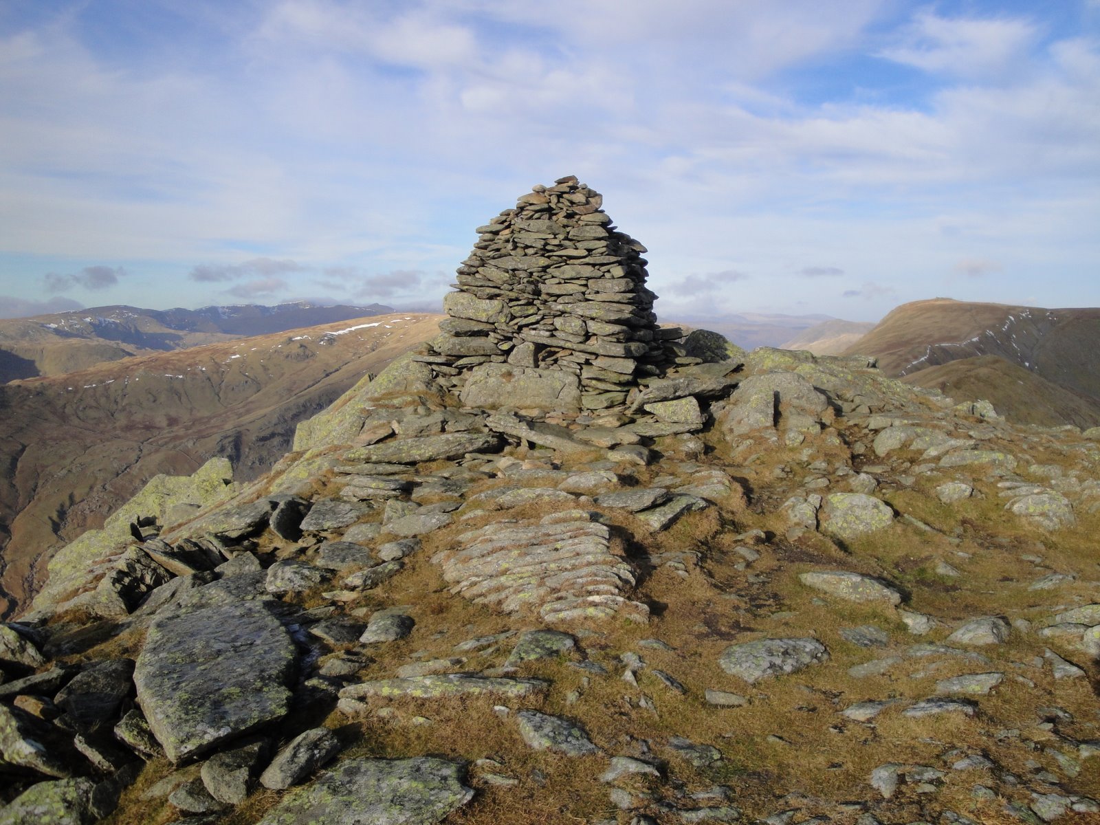
After doing a spot of repacking, I set off from Rannoch station shortly after 3:30pm. I headed east along the road for 2.5km before picking up the Road to the Isles track towards Corrour. It was quite hot and sunny but very, very hazy. I climbed Meall na Mucarach before reaching the summit of Sron Smeur (Marilyn) at around 5:30pm. I had a long rest on the summit, whilst admiring the views of the neighbouring hills.
The north slopes of Sron Smeur were quite steep and craggy in places, so it took longer than expected to reach Lochan Sron Smeur. The eastern shore appeared to be an ideal campsite, with short flat grass and a sandy beach so I opted to stop here for the night.
Friday, 22 April 2011
Rannoch to Corrour Backpack Plan
Overall Distance: 60.5km, Overall Ascent: 3690m
See route in new window with live progress
(Backup link without live progress)
As I unexpectetly was able to head off for a backpacking trip for Easter, I've choosen a 3-day walk from Rannoch Station to Corrour Station, via 6 Munros, a Corbett and a Graham. I plan to set off from Rannoch Station at approx 3pm this afternoon and aim to catch the train back from Corrour at lunchtime on Monday. If all goes to plan, you should be able to follow my progress using the link above.
See route in new window with live progress
(Backup link without live progress)
As I unexpectetly was able to head off for a backpacking trip for Easter, I've choosen a 3-day walk from Rannoch Station to Corrour Station, via 6 Munros, a Corbett and a Graham. I plan to set off from Rannoch Station at approx 3pm this afternoon and aim to catch the train back from Corrour at lunchtime on Monday. If all goes to plan, you should be able to follow my progress using the link above.
Sunday, 27 March 2011
Beinn Mhanach
Distance: 19.5km, Ascent: 920m, With Colin
See actual route in new window
Last spring whilst climbing Beinn a'Chreachain and Beinn Achaladair with Colin, we had considered including Beinn Mhanach in our walk but by the time we had reached Beinn Achaladair we decided that we didn't have enough daylight left to include it (and we were both tired!). Therefore we were both left with this single Munro, which we decided to go and bag today.
The Munro guide warned of limited parking at the start of the walk but in the end we were able to find space just off the main road, opposite the Auch Gleann. We set off walking at around 9:15am and soon passed the buildings at Auch and then under the railway viaduct, from where we got a good view up the glen to our hill for the day.
After a long walk up the glen on a good track, we eventually reached the low bealach from where the track descended down to Loch Lyon. We ascended on reasonably uniformly steep slopes, with occasional snow patches higher up, and reached the summit of Beinn Mhanach (Munro) soon after 1pm, where we stopped for lunch. The weather was reasonable with the cloud clear of most of the summits; therefore we had excellent views over the neighbouring hills, Rannoch Moor, the Ben Alder hills, Loch Lyon and the Ben Lawers hills.
We then detoured west to bag Beinn a'Chuirn (Munro Top) before heading south down steep slopes with occasional glissading down the few remaining snow patches. Eventually we reached the valley floor and the track back to the road. We returned to the car at around 4pm and set off on the long journey back home.
See actual route in new window
Last spring whilst climbing Beinn a'Chreachain and Beinn Achaladair with Colin, we had considered including Beinn Mhanach in our walk but by the time we had reached Beinn Achaladair we decided that we didn't have enough daylight left to include it (and we were both tired!). Therefore we were both left with this single Munro, which we decided to go and bag today.
The Munro guide warned of limited parking at the start of the walk but in the end we were able to find space just off the main road, opposite the Auch Gleann. We set off walking at around 9:15am and soon passed the buildings at Auch and then under the railway viaduct, from where we got a good view up the glen to our hill for the day.
After a long walk up the glen on a good track, we eventually reached the low bealach from where the track descended down to Loch Lyon. We ascended on reasonably uniformly steep slopes, with occasional snow patches higher up, and reached the summit of Beinn Mhanach (Munro) soon after 1pm, where we stopped for lunch. The weather was reasonable with the cloud clear of most of the summits; therefore we had excellent views over the neighbouring hills, Rannoch Moor, the Ben Alder hills, Loch Lyon and the Ben Lawers hills.
We then detoured west to bag Beinn a'Chuirn (Munro Top) before heading south down steep slopes with occasional glissading down the few remaining snow patches. Eventually we reached the valley floor and the track back to the road. We returned to the car at around 4pm and set off on the long journey back home.
Labels:
Argyll,
Argyll and Bute,
Day Walks,
Marilyns,
Munros,
Perth and Kinross,
Scotland
Location:
Perth and Kinross, UK
Saturday, 26 March 2011
Southern Black Mount Hills
Distance: 16km, Ascent: 1170m, With Colin
See actual route in new window
Colin & I set off from Stockport on Friday evening for a weekend in the Southern Highlands. We arrived at Bridge of Orchy at 1am, and pitched the tent near the river for the night.
After a lie in, we set off walking from Victoria Bridge at 10am and headed west alongside the Abhainn Shira. It was mainly overcast with cloud covering most of the summits, together with occasional showers as we walked along the landrover track. At the tiny Clashgour Hut we headed north on a good path, which at times was impeccably straight leading up into Coire Toaig.
After a couple of kilometers, we crossed a small ravine and ascended steeply up the broad ridge on the west side of the ravine. We reached the summit of Stob a'Choire Odhair (Munro), which was in the cloud, shortly before 1pm, where we had lunch.
As we descended the west ridge of Stob a'Choire Odhair, the cloud was soon left behind and the view opened up across to Stob Ghabhar. There was still plenty of large snow patches on the ridge, which were quite soft and very deep in places! The ground was steep for a couple of hundred metres up onto the Aonach Eagach ridge. The ridge itself was pleasantly airy as we once again climbed into the cloud and we soon reached the summit of Stob Ghabhar (Munro) soon after 3:30pm.
After retracing our steps for a few hundred metres, we then followed a fence line that contoured across to the SE ridge of Stob Ghabhar. As we dropped below the cloud base, we got a glimpse of the sea to the west (probably either Loch Etive or the Firth of Lorn). Once we had dropped down to approx 500m altitude the ground steeped and we clambered down a path near to the impressive Allt Coire na Muic waterfalls, which consisted of at least three separate large falls, with several smaller ones too.
Once below the waterfalls, we stuck close to the left bank of the Allt Coire na Muic down to its confluence with the Allt Toaig. I waded through the stream, which was no more than 20cm deep at the obvious crossing point. However Colin had less faith in the waterproof-ness of his boots; hence he opted for a boulder hoping route slightly further downstream, which lead to an amusing scramble up the bank on the far side!
The Clasgour Hut was open as we walked past it with a small group of people outside. A short distance further downstream we came upon a herd of deer crossing the river. Soon we were back at Victoria Bridge and we reached the car shortly after 6pm.
We returned to Bridge of Orchy and had dinner in the hotel before re-pitching our tent for the night at 9pm followed by a spot of stargazing whilst sampling the odd dram or two.
See actual route in new window
Colin & I set off from Stockport on Friday evening for a weekend in the Southern Highlands. We arrived at Bridge of Orchy at 1am, and pitched the tent near the river for the night.
After a lie in, we set off walking from Victoria Bridge at 10am and headed west alongside the Abhainn Shira. It was mainly overcast with cloud covering most of the summits, together with occasional showers as we walked along the landrover track. At the tiny Clashgour Hut we headed north on a good path, which at times was impeccably straight leading up into Coire Toaig.
After a couple of kilometers, we crossed a small ravine and ascended steeply up the broad ridge on the west side of the ravine. We reached the summit of Stob a'Choire Odhair (Munro), which was in the cloud, shortly before 1pm, where we had lunch.
As we descended the west ridge of Stob a'Choire Odhair, the cloud was soon left behind and the view opened up across to Stob Ghabhar. There was still plenty of large snow patches on the ridge, which were quite soft and very deep in places! The ground was steep for a couple of hundred metres up onto the Aonach Eagach ridge. The ridge itself was pleasantly airy as we once again climbed into the cloud and we soon reached the summit of Stob Ghabhar (Munro) soon after 3:30pm.
After retracing our steps for a few hundred metres, we then followed a fence line that contoured across to the SE ridge of Stob Ghabhar. As we dropped below the cloud base, we got a glimpse of the sea to the west (probably either Loch Etive or the Firth of Lorn). Once we had dropped down to approx 500m altitude the ground steeped and we clambered down a path near to the impressive Allt Coire na Muic waterfalls, which consisted of at least three separate large falls, with several smaller ones too.
Once below the waterfalls, we stuck close to the left bank of the Allt Coire na Muic down to its confluence with the Allt Toaig. I waded through the stream, which was no more than 20cm deep at the obvious crossing point. However Colin had less faith in the waterproof-ness of his boots; hence he opted for a boulder hoping route slightly further downstream, which lead to an amusing scramble up the bank on the far side!
The Clasgour Hut was open as we walked past it with a small group of people outside. A short distance further downstream we came upon a herd of deer crossing the river. Soon we were back at Victoria Bridge and we reached the car shortly after 6pm.
We returned to Bridge of Orchy and had dinner in the hotel before re-pitching our tent for the night at 9pm followed by a spot of stargazing whilst sampling the odd dram or two.
Location:
Argyll and Bute, UK
Wednesday, 19 January 2011
Kentmere Horseshoe
Distance: 18.5km, Ascent: 1090m, Solo
See actual route in new window
After the washout that was the weekend, I decided to take a day off work and head up to the Lakes for a round of the Kentmere horseshoe, which I've walked previously in June 2003 and April 2009.
I set off from Kentmere at 10:15am and headed west up the Garburn Pass track in the winter sunshine, passing Badger Rock. Once up in the coire, I left the path and headed up the slopes towards Buck Crag. The ground soon levelled out into frozen bog, through which I followed a faint path towards Yoke, which soon met the main path alongside the wall.
Mist was still clinging on in the valleys even though it was late morning, so there were good views South over a mist covered Windermere. I reached the summit of Yoke shortly after 11:30am and enjoyed some hot blackcurrant squash whilst taking in the excellent views. I continued on over Ill Bell and stopped for lunch on the sunny summit of Froswick. From this vantage point, I could see the majority of the southern and eastern fells, speckled with small patches of snow.
After lunch, I ascended north along the ridge before skirting the summits of Thornthwaite Crag and Mardale Ill Bell, staying near the coire edge. On the descent to the Nan Bield Pass there was a significant patch of steep snow to avoid at one point. As I ascended east from the pass, the views back over High Street were excellent. Soon I reached the summit of Harter Fell, where I stopped for another well earned rest.
I headed south along the ridge to Kentmere Pike and then continued to Goat Scar, whose summit appeared to be an unmarked rock near the fence. I then headed south to my final summit of the day, Shipman Knotts. There were two knolls that seemed to be of similar height so I visited the tops of both of them just to be certain, before descended south to the bridleway.
There were good views of the sunset as I walked along the track and road back to the car, which I arrived back at just before 5pm. It had been good to get out on a decent hill walk for the first time in a couple of months.
See actual route in new window
After the washout that was the weekend, I decided to take a day off work and head up to the Lakes for a round of the Kentmere horseshoe, which I've walked previously in June 2003 and April 2009.
I set off from Kentmere at 10:15am and headed west up the Garburn Pass track in the winter sunshine, passing Badger Rock. Once up in the coire, I left the path and headed up the slopes towards Buck Crag. The ground soon levelled out into frozen bog, through which I followed a faint path towards Yoke, which soon met the main path alongside the wall.
Mist was still clinging on in the valleys even though it was late morning, so there were good views South over a mist covered Windermere. I reached the summit of Yoke shortly after 11:30am and enjoyed some hot blackcurrant squash whilst taking in the excellent views. I continued on over Ill Bell and stopped for lunch on the sunny summit of Froswick. From this vantage point, I could see the majority of the southern and eastern fells, speckled with small patches of snow.
After lunch, I ascended north along the ridge before skirting the summits of Thornthwaite Crag and Mardale Ill Bell, staying near the coire edge. On the descent to the Nan Bield Pass there was a significant patch of steep snow to avoid at one point. As I ascended east from the pass, the views back over High Street were excellent. Soon I reached the summit of Harter Fell, where I stopped for another well earned rest.
I headed south along the ridge to Kentmere Pike and then continued to Goat Scar, whose summit appeared to be an unmarked rock near the fence. I then headed south to my final summit of the day, Shipman Knotts. There were two knolls that seemed to be of similar height so I visited the tops of both of them just to be certain, before descended south to the bridleway.
There were good views of the sunset as I walked along the track and road back to the car, which I arrived back at just before 5pm. It had been good to get out on a decent hill walk for the first time in a couple of months.
Labels:
Birketts,
Day Walks,
England,
HuMPs,
Lake District,
Lakes - Far Eastern Fells,
Wainwrights
Location:
Kentmere, Kendal, Cumbria LA8, UK
Saturday, 30 October 2010
Birks Fell and Horse Head Moor
Distance: 18km, Ascent: 510m
See route in new window
It was dull and overcast when I arrived in Buckden, but I was hopeful that it would improve as the weather forecast promised! I set off walking just before 11am and followed the bridleway SW up the hill. Near the summit of the bridleway, the path became flagged and I soon reached the trig point of Birks Fell, where I had lunch. I then followed the pleasant moorland ridge for the 2km to the true summit of Birks Fell, which was my final 2000ft peak in the Yorkshire Dales.
See route in new window
It was dull and overcast when I arrived in Buckden, but I was hopeful that it would improve as the weather forecast promised! I set off walking just before 11am and followed the bridleway SW up the hill. Near the summit of the bridleway, the path became flagged and I soon reached the trig point of Birks Fell, where I had lunch. I then followed the pleasant moorland ridge for the 2km to the true summit of Birks Fell, which was my final 2000ft peak in the Yorkshire Dales.
The going remained easy following the wall over Moss Top; however the next col was full of peat hags, which obviously slowed my progress down! By now it was quite sunny and pleasant, apart from the cool wind. I soon reached the true summit of Horse Head Moor, from where I admired the view of many of the major peaks of the Dales.
Continuing along the ridge, I detoured to the trig point on Horse Head Moor, before dropping down to Yockenthwaite. It was then a pleasant stroll back through Wharfdale, following the Dales Way to Buckden.
Saturday, 2 October 2010
Meall Greigh, Meall Garbh & An Stuc
Distance: 18km, Ascent: 1260m, Solo
See actual route in new window
We were away in the Southern Highlands for our first weekend away with Isabel, and I was able to sneak in a day's Munro bagging! Lynsey dropped me off at Lawers village at around 10:15am and I headed up the path alongside the Lawers Burn. Soon it started to rain so I donned waterproofs, which ensured the rain soon stopped!
After a brief break I headed up into the mist roughly following the line of a stream. After around 300m of ascent, the ground levelled out into a bog. In strengthening winds, I ascended the final 200m up to the summit of Meall Greigh (Munro). I dropped down the NE slopes a few metres to get out of the wind for lunch, where I was soon joined by a group of four other walkers.
Despite the strong winds, I decided to continue with my planned walk on the assumption that the wind would be become less strong as the ridge became much broader, which turned out to be correct. There was a reasonably clear path for much of the way, roughly following the line of fence; although it was somewhat vague through the boggier areas.
After a couple of km, I reached a bealach and started my ascent of Meall Garbh. I got buffeted by the wind quite a bit on the ascent, especially where the ridge narrowed, and the rain continued to fall relentlessly. I detoured off the path to visit a rocky knoll, which turned out not to be the summit. However, soon I did reach the true summit of Meall Garbh (Munro).
After a quick break, I continued along the SW ridge from Meall Garbh. After descending to a bealach, I then ascended the steep slopes of An Stuc, which involved occassional bits of easy scrambling. There seemed to be several different well worn routes up the craggy slope that I could make out in the mist. Soon I was on the summit of of An Stuc (Munro), stopping for another quick break.
I descended to the bealach to the south of An Stuc, where I had to decide whether to continue to Ben Lawers or whether to descend. As it was now 3:30pm and the weather was still vile, I decided that I would descend. There was a faint path descending from the bealach, which I followed, but it soon petered out so I picked a route down staying close to the stream. The stream went over a few waterfalls where the ground became craggy, but I was able to find a route down through the crags.
Eventually I reached Lochan nan Cat, where the mist began to clear. I followed the north shore to it's east end and then followed a faint path down to the head of the vehicle track. From there I followed the path alongside the Lawers Burn back to the A827 and thence back to the car, where I arrived just before 6pm.
See actual route in new window
We were away in the Southern Highlands for our first weekend away with Isabel, and I was able to sneak in a day's Munro bagging! Lynsey dropped me off at Lawers village at around 10:15am and I headed up the path alongside the Lawers Burn. Soon it started to rain so I donned waterproofs, which ensured the rain soon stopped!
After a brief break I headed up into the mist roughly following the line of a stream. After around 300m of ascent, the ground levelled out into a bog. In strengthening winds, I ascended the final 200m up to the summit of Meall Greigh (Munro). I dropped down the NE slopes a few metres to get out of the wind for lunch, where I was soon joined by a group of four other walkers.
Despite the strong winds, I decided to continue with my planned walk on the assumption that the wind would be become less strong as the ridge became much broader, which turned out to be correct. There was a reasonably clear path for much of the way, roughly following the line of fence; although it was somewhat vague through the boggier areas.
After a couple of km, I reached a bealach and started my ascent of Meall Garbh. I got buffeted by the wind quite a bit on the ascent, especially where the ridge narrowed, and the rain continued to fall relentlessly. I detoured off the path to visit a rocky knoll, which turned out not to be the summit. However, soon I did reach the true summit of Meall Garbh (Munro).
After a quick break, I continued along the SW ridge from Meall Garbh. After descending to a bealach, I then ascended the steep slopes of An Stuc, which involved occassional bits of easy scrambling. There seemed to be several different well worn routes up the craggy slope that I could make out in the mist. Soon I was on the summit of of An Stuc (Munro), stopping for another quick break.
I descended to the bealach to the south of An Stuc, where I had to decide whether to continue to Ben Lawers or whether to descend. As it was now 3:30pm and the weather was still vile, I decided that I would descend. There was a faint path descending from the bealach, which I followed, but it soon petered out so I picked a route down staying close to the stream. The stream went over a few waterfalls where the ground became craggy, but I was able to find a route down through the crags.
Eventually I reached Lochan nan Cat, where the mist began to clear. I followed the north shore to it's east end and then followed a faint path down to the head of the vehicle track. From there I followed the path alongside the Lawers Burn back to the A827 and thence back to the car, where I arrived just before 6pm.
Location:
Lawers, Aberfeldy, Perthshire PH15, UK
Subscribe to:
Posts (Atom)