Sunday, 29 June 2008

Arenig Fawr and Moel Llyfnant

Sunday 29th June 2008 

A windy day walk in Snowdonia's Arenig hills 

Distance: 12km; Ascent: 660m; Windy, initially with low cloud and rain; with Lynsey

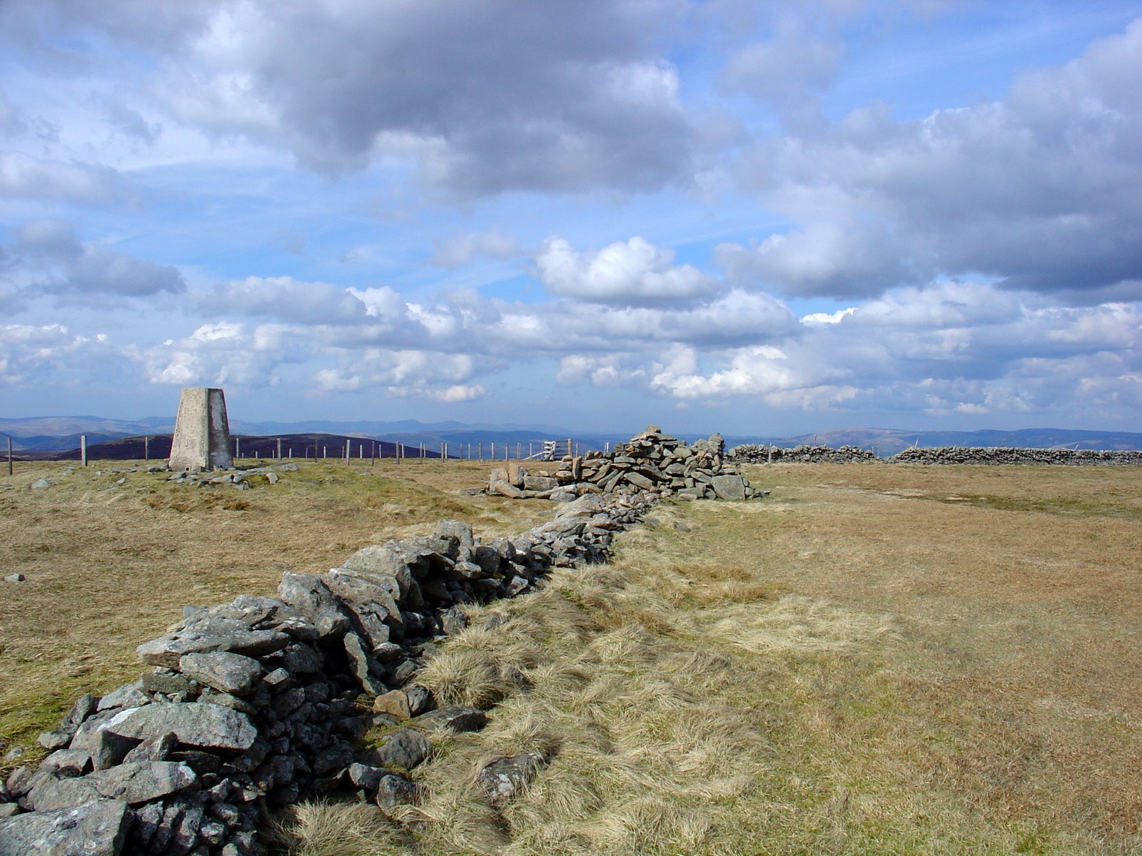
We set off walking with the intention of following the walk in the Nuttalls' guidebook, but as we ascended up onto Arenig Fawr the weather deteriorated. On the summit of Arenig Fawr (Marilyn, Nuttall) it was wet, windy and misty so we didn't linger for long by the trigpoint.

Dropping down the south ridge we visited the summits of Arenig Fawr South Top (Nuttall) and Arenig Fawr South Ridge Top (Nuttall), before descending west to the col. By now the weather had begun to improve and the cloud parted to reveal blue sky and spells of sunshine.

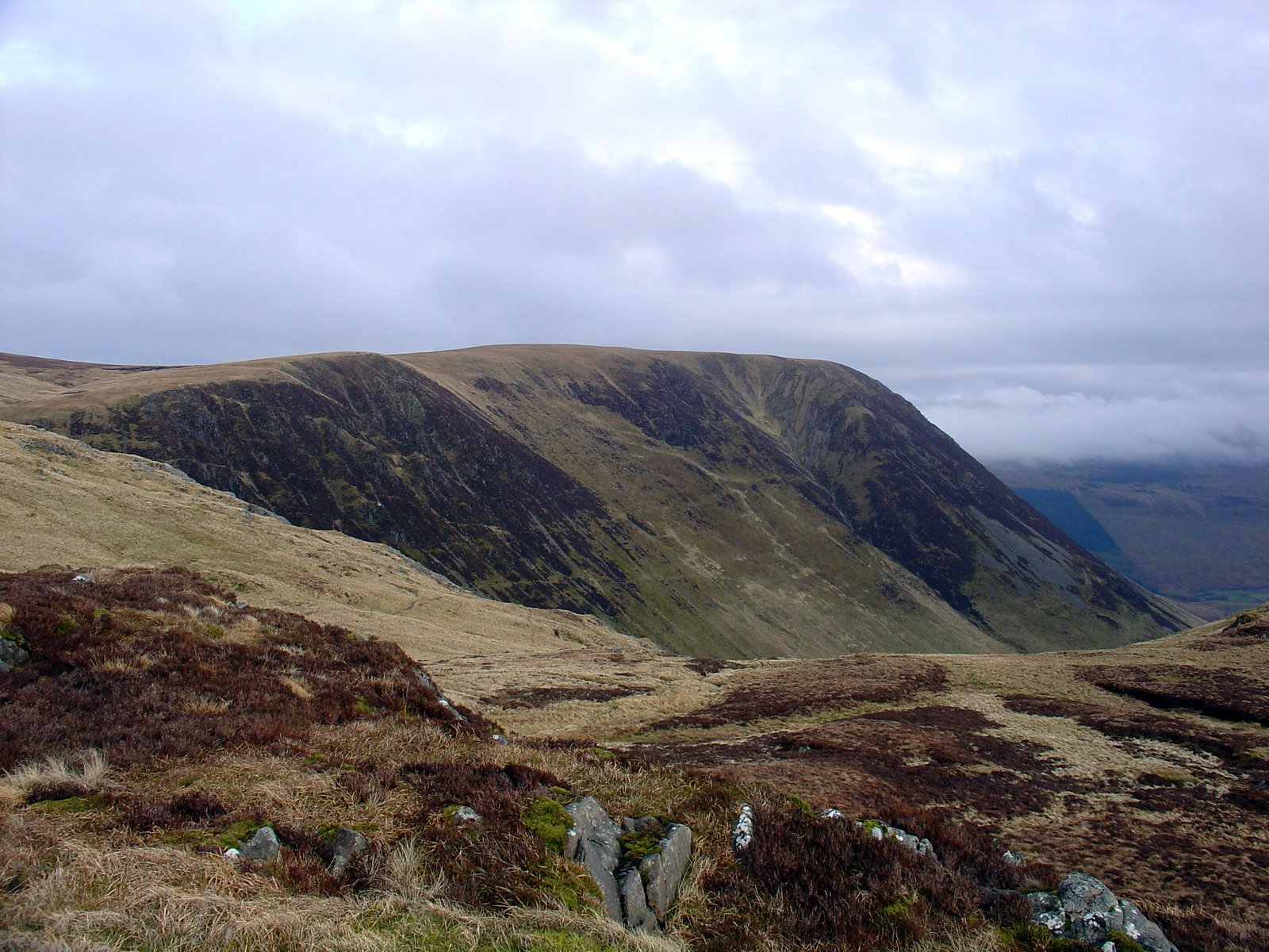
Arenig Fawr from Moel Llyfnant
Arenig Fach and Arenig Fawr from Moel Llyfnant
We continued on with our planned walk and ascended steeply westwards to reach the summit of Moel Llyfnant (Marilyn, Nuttall) at around 3pm. There were good views from up here across to both Arenig Fawr and Arenig Fach in the distance.

Arenig Fach and Arenig Fawr from N slopes of Moel Llyfnant
Arenig Fawr from N slopes of Moel Llyfnant
By now time was getting on so we decided that we didn't have time to complete our planned walk over two more minor tops. Therefore instead we opted to descend northwards back towards the car (although the route shown on the map is only my best guess of what we actually walked!)

Written up in September 2013 from memories and photos

Monday, 28 April 2008

Moffat to Peebles - Day 3: Blackhouse Heights to Peebles

Distance: 16km, Ascent: 340m

See route in new window

Owing to the lack of integrated public transport system in the borders, it was necessary for us to rise early this morning so that we could get back to Moffat by bus (via Edinburgh!).  We set off walking at around 6am; the weather was fine with the hills free of cloud.  It was a quick ascent to the top of our first hill of the day: Black Cleuch Hill (Donald Top).

We continued following the heathery ridge for several km to reach
Dun Rig (Graham) at 7:30am.  An hour later we were on the top of Birkscairn Hill (Donald).  From there we followed the Old Drove Road north along the ridge over the top of Kirkhope Law (Donald Dewey), and then skirting Kailzie Hill and Craig Head.  Shortly after 9:30am we got our first view of Peebles and could see the gathering dark clouds; would we be able to get to there before the rain started?

Once we reached Pebbles our pace quickened as we realised we had no idea where the bus to Edinburgh would stop!  Shortly before crossing the Tweed, the rain started and we ran over the bridge and into the town centre in search of the bus stop.  In the end we had time to spare and I was able to nip into a bakery to pick us up some tasty pastries.  Eventually we arrived back in Moffat after spending an hour between buses in Edinburgh.  However the walking of the last three days was worth it!


Written up in November 2010 from memories and photos

Sunday, 27 April 2008

Moffat to Peebles - Day 2: Talla Nick to Blackhouse Heights

Distance: 23km, Ascent: 1090m

See route in new window

We awoke to a dry morning, with the mist still clinging on in a few places; however by the time we started walking at 9:30am it had all cleared.  Our first hill for the day was Lochcraig Head (Donald), from where there were good views down to Loch Skeen.  We then descended the ridge to the north to Nickies Knowe (Donald Top), from where the views were excellent across to Talla Reservoir and Broad Law.

We dropped to our low point for the day at the Megget Stone, before ascending the long south ridge of Broad Law (Corbett).  The summit was adorned with a strange collection of masts together with the more usual trig point, which we reached at 1:30pm.  We then headed north-east to climb Cramalt Craig (Donald), followed by Fifescar Knowe (Donald Top) and Dollar Law (Donald).

From the summit of Dollar Law, we retraced our steps for half a km, before taking a traversing path round the east side of Fifescar Knowe to reach Notman Law (Donald Top).  Skirting round the head of the Manor Valley, we reached Greenside Law (Donald).  We then headed over Black Law (Donald), before camping in the Bealach just before Black Cleuch Hill.  All in all, a very good day’s walking with excellent weather!


Written up in November 2010 from memories and photos

Saturday, 26 April 2008

Moffat to Peebles - Day 1: Moffat to Talla Nick

Distance: 21km, Ascent: 1180m

After driving up from Stockport this morning, we set off from Moffat late morning in the rain and headed north along the Birneck Water.  After a few km, we climbed up steep rough ground to reach Greygill Head, where the slope eased.  We continued up to Swatte Fell (Donald) in the mist.  As we reached Falcon Craig (Donald Top), the mist started to clear and we could start to make out our first Corbett of the day: Hart Fell.  By the time we reached the summit of Hart Fell (Corbett), just after 4pm, the cloud had completely cleared and we had excellent views, if a bit overcast.

We then headed east over a succession of minor tops, to reach Firthhope Rig (Donald Top) as the cloud was starting to lower again.  We made a detour to bag White Coomb (Corbett) at approx 6:30pm, before heading over Firthybrig Head to camp in the mist at Talla Nick.


Written up in November 2010 from memories and photos

Monday, 24 March 2008

Pennine Way: Day 5a - Malham to Settle

Monday 24th March

Distance: 12km; Ascent: 320m; Mainly dry and sunny, but windy; with Lynsey

After a cold night at the campsite in Malham, we were a bit sluggish at getting going this morning and so it was well after 9am before we were walking.  We picked up the broad path towards Malham Cove, which was relatively quiet at this time of the morning on a snowy Easter Monday.

Heading towards Malham Cove
The steep path to the west of the cove brought us up to the impressive limestone pavement above, with excellent views back down the valley.

Limestone pavement above Malham Cove
View from top of Malham Cove
The thin layer of snow over the limestone pavement meant for slow progress as we took it carefully to avoid slipping!  Eventually we reached the path through the dry valley of Watlowes, which was quite pretty in the snow today.

Above Malham Cove
It was now apparent that due to the time, we would struggle to finish our planned walk to Horton-in-Ribblesdale in the light.  There was also the important matter of arriving in time to catch a train home!  Therefore we opted to strike west across the moorland towards Settle, with the aim of catching a train home from there instead.

Pen-y-Ghent
Ingleborough, Whernside and Pen-y-Ghent
We followed a reasonable track westwards over the snow covered moors.  By now there was much blue sky about, which resulted in excellent views across to the Yorkshire 3 Peaks of Ingleborough, Whernside and Pen-y-Ghent in the distance across the moorland.

Heading towards Settle
The path eventually brought us to the minor road above Langcliffe, from where we picked up an extremely muddy bridleway down into Settle itself, where we arrived in the mid-afternoon.  As we had a bit of time to kill before the next train, we popped into one of the many cafes to relax after an excellent four days of walking.

Written up in October 2012 from photos and memories

Sunday, 23 March 2008

Pennine Way: Day 5 - Lothersdale to Malham

Sunday 23rd March

Distance: 24.5km; Ascent: 540m; Dry, sunny but windy; with Lynsey

I was woken up at around 3am by Lynsey due to her concern about the strange sagging of the tent roof.  Looking outside, my fears were confirmed as it was snowing heavily.  Our Terra Nova Voyager tent is indeed an excellent 3-season backpacking tent, but it wasn't handling the snow particularly well this morning with lots of it settling on the top flattish section of the flysheet.  And so I dressed up warm and headed outside to clear a substantial amount of snow from the tent roof on this jolly cold start to Easter day.  It continued to snow heavily for the next hour or so, which meant that I had to stay outside to keep the tent clear.  However by around 4:30am ish I decided that the snow had now calmed down enough for me to safely return to the warmer confines of the tent :)

The weather had improved significantly by the time we set off walking at around 9ish, with sun and blue skies!  And what a difference there was in the scenery, which was now covered with a reasonable layer of white stuff (that which the tent complained about!).

On the way up Pinhaw Beacon
Pennine Way signpost
We climbed up through the snow to reach our only summit of the day: Pinhaw Beacon (HuMP).  The views from up here were indeed excellent, enhanced today by the snowy landscape - not quite what you expect on Easter Sunday!  I regretted not having brought my sunglasses with me as the landscape was quite bright today!

On the summit of Pinhaw Beacon
After sufficient time to take in the views we descended to the road just to the west before continuing downhill for the next few kilometres to reach Thornton-in-Craven.  Around half an hour's walk later we reached the banks of the Leeds and Liverpool Canal and the famous double arched bridge.

Leeds & Liverpool Canal
Double arched bridge on Leeds & Liverpool Canal
We pushed onto Gargrave, where I have a feeling we might have stopped for tea and cake somewhere but I'm not too certain!  And then it was onwards to Airton followed by the home straight into Malham where we set up camp at the nearly deserted campsite in the gathering gloom of the pre-clock change dusk.

Due to the clear skies it soon became very cold, and so we took the sensible decision to retire to the pub :-)  It was around this point that I discovered that the map was nowhere to be seen :(  After a thorough search I came to the conclusion that we must have dropped it at some point, which was a tad annoying!  We were planning on setting off early in the morning, which was likely to be before any map selling shops were open.  However I guessed that the YHA were likely to sell maps at their reception and so nipped in and was in luck :)

After a some pleasant ale (probably Black Sheep), we wandered through the chilly streets of Malham to retire to our tent for the night in preparation for a long day in the hills tomorrow: Malham Cove, Fountains Fell and Pen-y-ghent.  However not all would go to plan tomorrow...

Written up in August 2012 from photos and memories

Saturday, 22 March 2008

Pennine Way: Day 4 - Blackshaw Head to Lothersdale

Saturday 22nd March

Distance: 27.5km; Ascent: 800m; Dry, sunny but windy; with Lynsey

After an unexpected comfortable night indoors and the pleasures of a cooked breakfast this morning, we set off walking and soon rejoined the Pennine Way.  We descended down through fields to reach a pleasant footbridge over Colden Water, where it was noticeably cold as the sun had yet to reach the valley bottom this morning!

Bridge over Colden Water
We ascended northwards across farmland to eventually emerge onto open moorland, where we traversed the north-east side of Standing Stone Hill before descending northwards towards the dam of Gorple Lower Reservoir.  The next section of path took us along the pleasant little moorland valley of Graining Water before picking up a private roate towards Walshaw Dean reservoirs where there was a sign that bizarrely warned us to beware of members of the public!

Graining Water
Beware of Lynsey!
Luckily we didn't come across any other members of the public on the private road so there was no need to worry!  After crossing the dam of the lower reservoir we picked up a path to reach the east shore of Walshaw Dean Middle Reservoir.

By Walshaw Reservoirs
Just over a hundred metres of ascent now lay before us, some on slabbed paths, before we reached the ruins of Top Withins where the path suddenly became somewhat busier!  And we even came across a signpost which was in Japanese as well as English!  Clearly this area of moorland must be popular with international visitors!

Near Top Withins
After descending to pass Ponden Reservoir, we ascended up onto another area of South Pennine moorland to pass Little Wolf Stones before descending again to reach Cowling.  Just a few kilometres left for us now as we walked across undulating fields and minor roads to reach Lothersdale at dusk, just avoiding having to get headtorchs out!

Lambs somewhere near Cowling
Our campsite for the night appeared to be someone's garden on the edge of the village, where after dinner we wandered down to the pub for a drink before retiring to bed, on quite a cold evening for early spring - snow was on the way!

Written up in August 2012 from photos and memories