Tuesday, 26 July 2011

Longridge Fell

Distance: 4.5km; Ascent: 100m; with Isabel

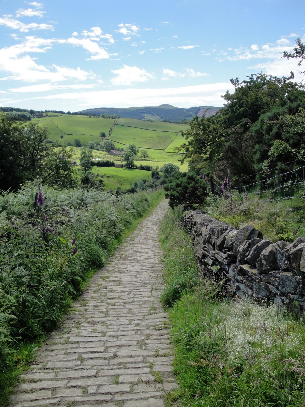
Again the weather was forecast to be good for the day that I had off work with Isabel, so I opted to go for a walk in the hills with Isabel in the rucksack carrier.  My chosen hill for the morning was Longridge Fell, and we set off walking at around 10:45am from the viewpoint carpark at Jeffrey Hill.  It was warm and dry with little wind, but mostly overcast, when we set off.

I had planned a bit of a circular walk, with a short detour to bag the summit, so we set off walking along the signposted permissive footpath heading ENE across the moor.  Initially the path was clear and distinct as we passed a flock of sheep, but it soon became indistinct when we reached the boggier ground.  However the wet ground was shortlived and we soon reached a very clear path coming in from the left.

This path soon arrived at the wall that runs along the ridge; we turned left and followed the wall for around a kilometre to reach the trigpoint on the the summit of Longridge Fell (Marilyn) at around 11:15am.  By now the cloud had started to break and it was turning into a warm sunny day.  After a short while admiring the view from the summit, which takes in the Forest of Bowland and southern Yorkshire Dales around to Winter Hill, we returned alongside the wall for just short of half a kilometre.

To vary the return route slightly, I decided to take the right of way south through the forest.  This turned out not to be such a good idea as the path was boggy in places and there was one section where I had to remove the rucksack carrier due to some low tree branches, which made for slow going.  However after a few 100m I reached a junction with a good path, which I took and it headed westwards back to the ridgetop wall.  Upon reaching the wall I turned left, initially along ground I had already covered in ascent; however at the next path junction I opted to stick with the path alongside the wall.  I reached the road in under a kilometre and turned right, uphill, back towards the car, which I reached soon after midday.

Sunday, 24 July 2011

Shutlingsloe

Distance 5.5km; Ascent: 230m; with Lynsey & Isabel

The weather this weekend was significantly better than last weekend, which had been a washout, so we decided to take Isabel out for a hill walk this morning.  Our choice of hill was Shutlingsloe, which is a shapely small hill just to the south of Macclesfield Forest.

We set off walking from the Trentabank carpark at around 10:30am under overcast skies and started to ascend gently up through the forest on good tracks.  After about half an hour we left the forest and continued on a slabbed path towards Shutlingsloe with occasional sunshine.  We reached the summit of Shutlingsloe (Dewey, HuMP) at 11:15am where we admired the views across to Shining Tor; however we didn't linger too long as it was quite windy up there with little options for shelter with Isabel in the rucksack carrier.

We returned back to the forest by our route of ascent and took an alternative track back to the carpark, which we reached at around midday, where we enjoyed ginger beer and ice cream :)

Tuesday, 12 July 2011

Werneth Low Country Park

Distance 3km; with Isabel
I had the day with Isabel today and the weather was forecast to be nice so I decided to go for a morning walk. I have wanted to go to Werneth Low for a while to have a wander around and thought that this was a good opportunity. Therefore I set off walking from the visitors' centre carpark at around 10:15am with Isabel in the rucksack carrier.

It was a short climb uphill initially to reach the war memorial where there were excellent views across to the Peak and the West Pennine Moors. The sky was mostly overcast, but with occasional sunny interludes. I then picked up the Trans Pennine Trail and followed it eastwards as it contoured along the northern edge of the hill. I left the Trans Pennine Trail where it joined the road and headed westwards along the footpath just to the north of the road. After a short section of road walking, I picked up another footpath across the fields to return to the car park at around 11am. A pleasant stroll with excellent views.

Sunday, 3 July 2011

A stroll near Bollington

Distance: 4km; with Lynsey & Isabel

As we already had plans for this afternoon, we decided to go for a short walk this morning as the weather was so nice.  Our Cheshire ATP walks book had a pleasant sounding walk near Bollington, which we opted for.  We set off from the car park just east of Whiteley Green at around 10:15am and headed for the Middlewood Way, a disused railway line.  There was a flight of 20 or so gentle steps down from the road,  which we carried Isabel down in the pushchair.

We headed south along the track and after about a kilometre we crossed the viaduct above Bollington before leaving the Middlewood Way and heading over to the Macclesfield Canal.  We followed the towpath back north with good views and reached the car at around 11:15am after a pleasant stroll.


Sunday, 26 June 2011

Tegg's Nose Trail

Distance: 4km; Ascent: 200m; with Lynsey & Isabel

Will the weather forecast promising temperatures of 27°C, we opted for a walk in the relative cool of the morning; although having said that it was still quite hot!  We had decided on a 4km circuit of Tegg's Nose, which we hadn't been to since walking the Gritstone Trail back in early 2008.

We set off walking from the visitors' centre shortly before 11am, having been delayed by lots of traffic jams on route.  There were good views across to Shutlingsloe as we descended down a stone track and then skirted the eastern side of the hill to reach Tegg's Nose Reservoir.  From here, there was a section of steep ascent through the woods before we reached the more level path near the top of Tegg's Nose.

The views were good from up here as we walked past the some of the preserved old quarry equipment.  The whole area at the top of the hill was covered with heather and bilberry with the occasional foxglove, so there were plenty of purple flowers around.  Some people appeared to be bilberry picking, although I didn't actually see any ripe berries myself.  We returned to the visitors' centre at around 12:30pm, where we enjoyed ice cream in the shade before heading home.

Sunday, 12 June 2011

Sale Water Park

Distance: 5km; with Lynsey, Isabel, Mum & Dad

We decided to go for a more local walk today and settled on a visit to Sale Water Park.  We set off walking soon after 10am and headed down to the edge of the lake to find it quite smelly and stagnant.  Therefore we instead headed along the south bank of the River Mersey to Barfoot Bridge.  Here we crossed to the northern bank and started to head back towards the cars.  After a short distance, the rain started and gradually became heavier as we regretted not having brought waterproofs with us; Isabel on the other hand was quite dry as we did have the pushchair rain cover with us!  We reached the cars at around 11:30am and headed home to dry out.

Saturday, 11 June 2011

Two strolls in the Peak

Monsal Head Distance: 3km; Bugsworth Distance: 2km; with Lynsey, Isabel, Mum & Dad

I had recently heard that the tunnels on the Monsal Trail had been reopened for the first time since the railway line closed, which meant that it was no longer necessary to divert from the old railway line when trying to follow the Monsal Trail. Therefore, with my parents visiting, we headed off for a short 3km stroll around and underneath Monsal Head with Isabel in her rucksack carrier.

We set off from the carpark at Monsal Head at approx 11am under sunny skies and headed east along the road to Little Longstone, where we picked up the former route of the Monsal Trail along a footpath to eventually join up with the old railway line. From here we headed back west along the Monsal Trail to enter the Headstone Tunnel. The trail through the tunnel was quite busy, but reasonably well lit as we admired the engineering of the tunnel. Soon after leaving the tunnel we crossed the Monsal Viaduct with excellent views down to the Dale below; it must have been an impressive sight when travelling by train after having come through the tunnel. We headed back up the hill to reach Monsal Head just as it started to rain soon after midday so we headed into the tearoom for lunch.

On the way back home, we took a short detour to visit the Bugsworth Canal basin, near Whaley Bridge where some sort of festival was taking place that seemed to involve lots of people demonstrating the different sorts of engines that can be used in canal boats! We wandered along the towpath for around a kilometre from the carpark before returning to enjoy some ice cream.