Saturday 14th September 2013
A quiet six hour walk on the highest ground in Mid Wales
Distance: 15.5km; Ascent: 710m; Sunshine and showers; Solo
I had plans for a two day backpack this weekend, possibly staying in one of the MBA bothies south of Pumlumon, but the dreadful weather forecast for Sunday put me off this idea somewhat! However after studying the map I realised that with a few route modifications I could still just about manage to climb the six hills I had planned for the weekend in just one day: a day walk up the five Pumlumon hills followed by an evening walk up Pen y Garn, so that is what did!
After having driven over from Stockport this morning, my plans were almost thwarted by a road closure but luckily I was still above to reach my planned starting point on the eastern shores of Nant y Moch Reservoir. I set off walking at around 10:30am and headed SW over rough ground alongside the Nant y Moch stream, before crossing a barbed wire fence at a dilapidated stile and beginning to ascend.
 |
| On the way up Y Garn from Nant-y-Moch Reservoir |
 |
| Nant-y-Moch Reservoir |
It was now quite warm so I stopped briefly to change into shorts before continuing my ascent up the grassy slopes of Y Garn with good views back down to Nant y Moch Reservoir and over to Pumlumon Fawr. Eventually I reached the summit of
Y Garn (Nuttall) where I decided to stop for an early lunch.
 |
| Summit of Y Garn with Pumlumon in the distance beyond |
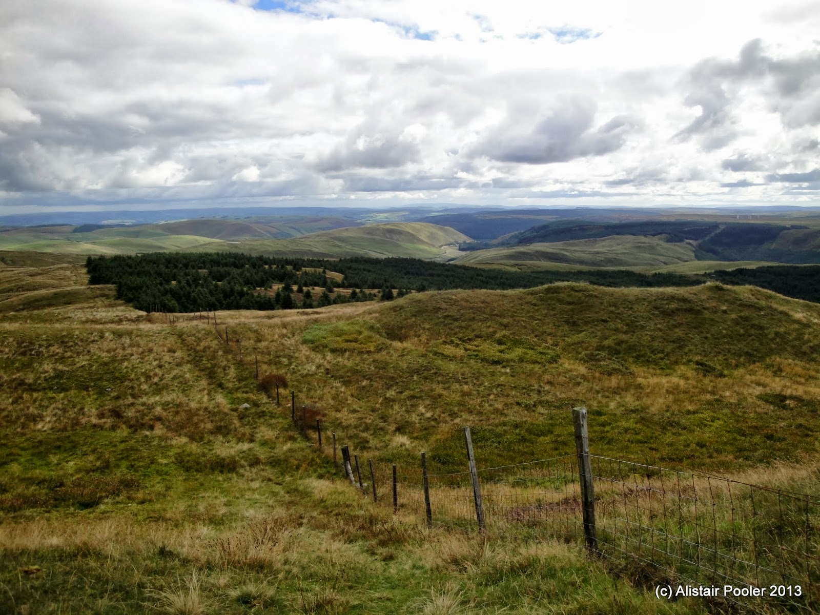
There were good views from here, especially of the rapidly approaching rain clouds! After donning my waterproofs I descended eastwards along the undulating ridge with good views in all directions. I could make out this evening's hill, Pen y Garn, to the south, together with a large windfarm nearby.
 |
| Heading east from Y Garn |
 |
| The Cefn Croes windfarm from the north |
 |
| Research Equipment from Aberystwyth University |
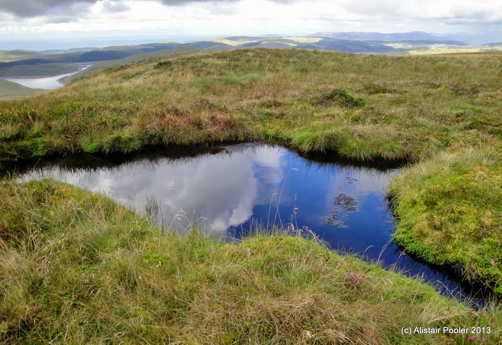
I passed a series of pairs of small circular fences that were apparently something to do with a research project at Aberystwyth University before joining the south ridge of Pumlumon at the forest corner. I ascended past the only two only walkers I saw today with good views, especially westwards back down to Nant y Moch Reservoir.
 |
| Pond on the S ridge of Pumlumon |
 |
| Nant-y-Moch Resevoir from Pumlumon |
At around 1pm I reached the many cairns and the
trigpoint on the summit of
Pumlumon Fawr (Marilyn, Nuttall) where I stopped for a second lunch break at my highest point for the day.
 |
| Large windshelter cairn on Pumlumon Fawr summit |
There were excellent views from here, which was to be expected as it's the highest point south of Cadair Idris and north of the Brecon Beacons and Black Mountains. It was a shame however that the view to the south was blighted by the large windfarm at Cefn Croes; and this was certainly not the only windfarm I could see!
 |
| On Pumlumon Fawr summit |
 |
| Pumlumon Fawr summit trigpoint |
I descended the steep ground to the NW before the short ascent to the cairn on the summit of
Pumlumon Fach (Nuttall).
 |
| Summit of Pumlumon Fach |
After retracing my steps for a few hundred metres, I took a traversing line above the cliffs overlooking Llyn Llygad Rheidol in the corrie below.
 |
| Llyn Llygad Rheidol |
 |
| Pumlumon Fawr from the east |
Once I was on the east ridge of Pumlumon Fawr it was a gentle walk eastwards to reach the grassy summit of
Pen Pumlumon Llygad-bychan (Nuttall).
 |
| Summit of Pen Pumlumon Llygad-bychan |
 |
| Boundary stone on Pen Pumlumon Llygad-bychan |
A couple of boundary stones indicated the onwards route across the peaty moorland, with a slight drop followed by a bit of ascent to reach the two ancient cairns on the summit of
Pen Pumlumon Arwystli (Nuttall). According to hill-bagging.co.uk, the southerly cairn is the highest so this is the one I choose to stop at for a quick break as another heavy shower arrived.
 |
| Ancient cairns on the summit of Pen Pumlumon Arwystli |
I retraced my steps for just over a kilometre before picking my way down the steep ground to reach the shores of Llyn Llygad Rheidol, which is another reservoir.
 |
| Llyn Llygad Rheidol |
 |
| Llyn Llygad Rheidol |
From the dam I picked up a reasonable vehicle track, which skirted around the north ridge of Pumlumon Fach before gradually descending down to the road a short distance away from my car. It had been a pleasant walk in what seemed to be a little frequented area of hills. Now it was time to drive southwards for half an hour to start my second walk of the day: the ascent of Pen y Garn.
See also my Social Hiking
live map from the walk.


No comments:
Post a Comment